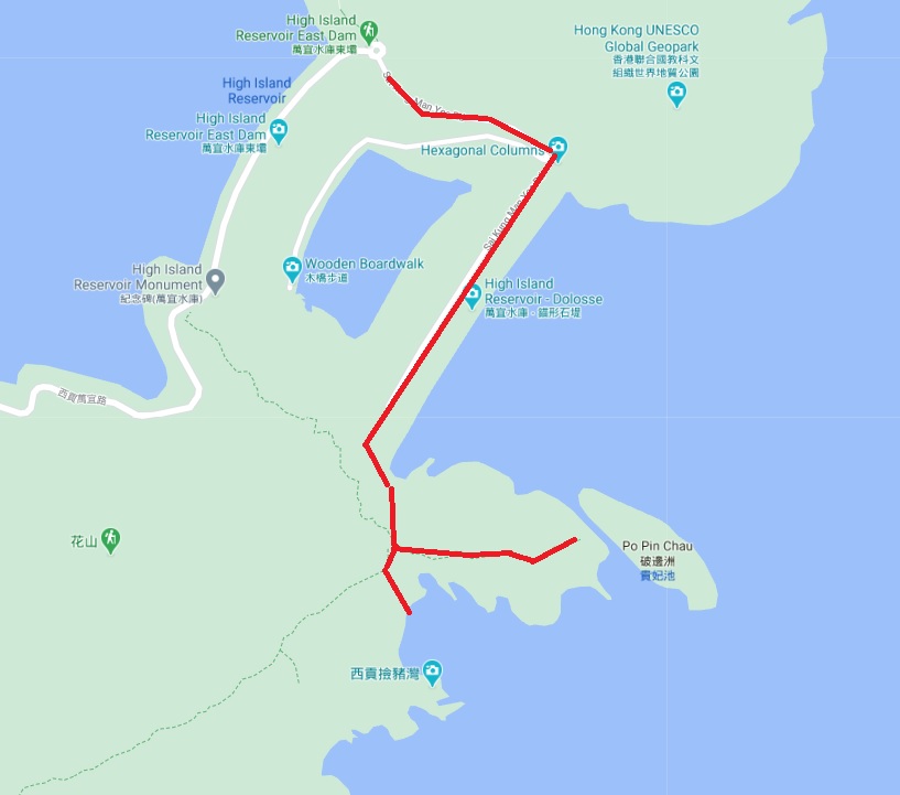
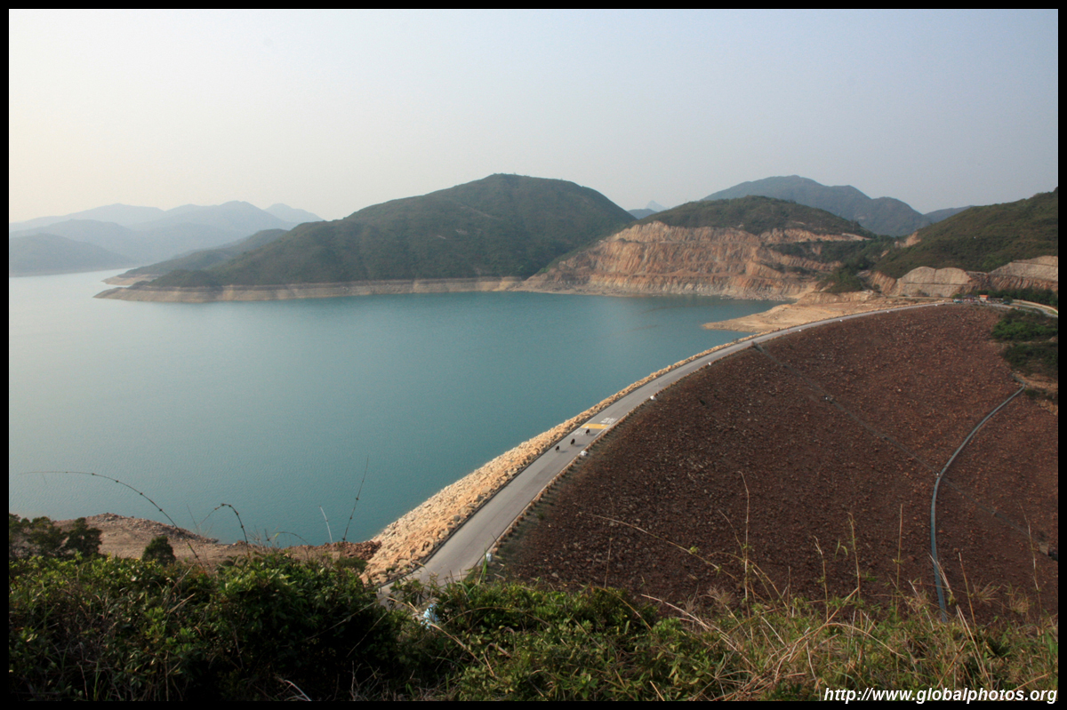
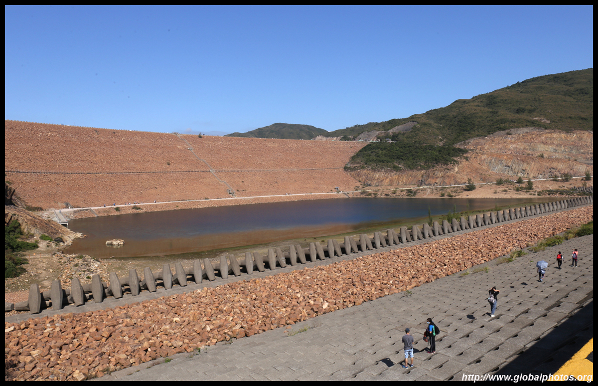
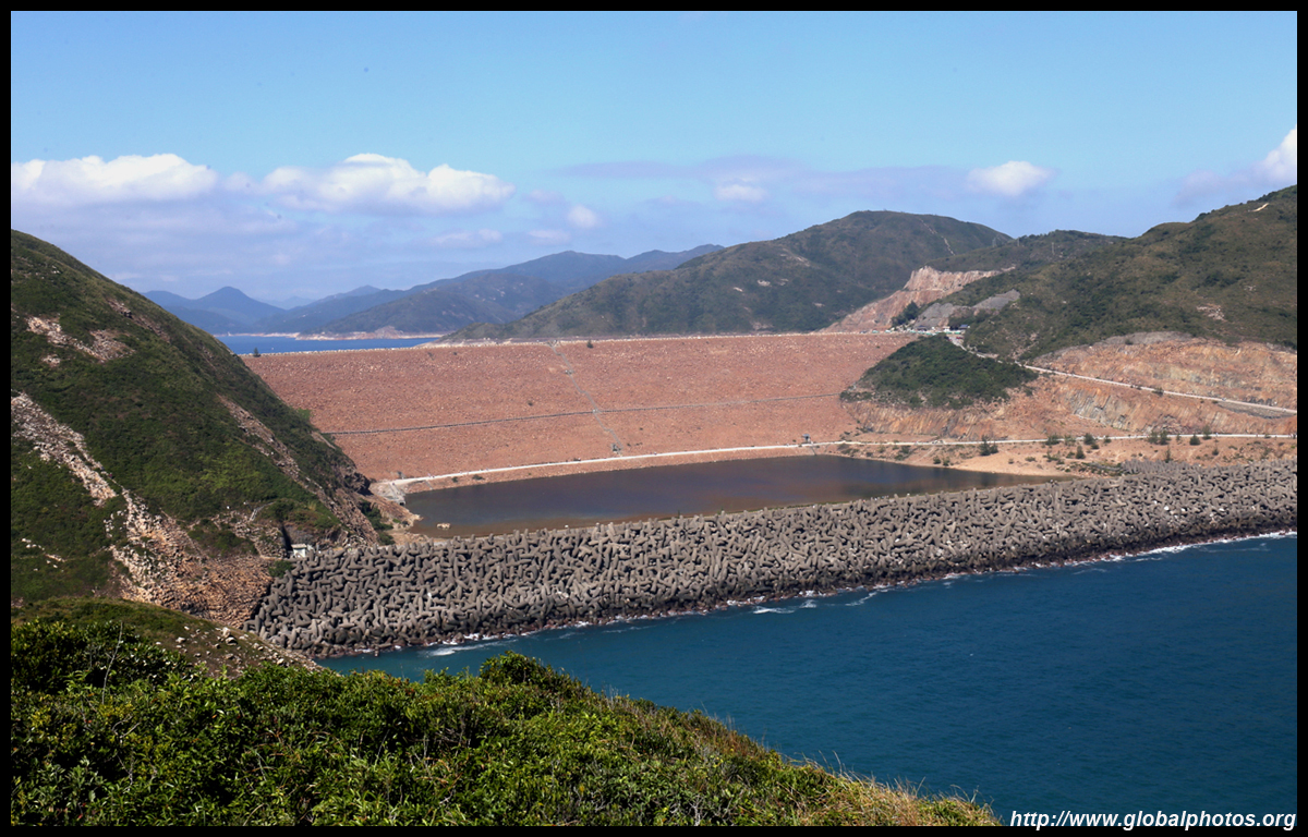
High Island is the city's 2nd reservoir, built by sealing the coast with dams. In the late 1960s, water security was at stake when mainland China shut their supply tap, and the colonial government went on a building spree to secure fresh water.
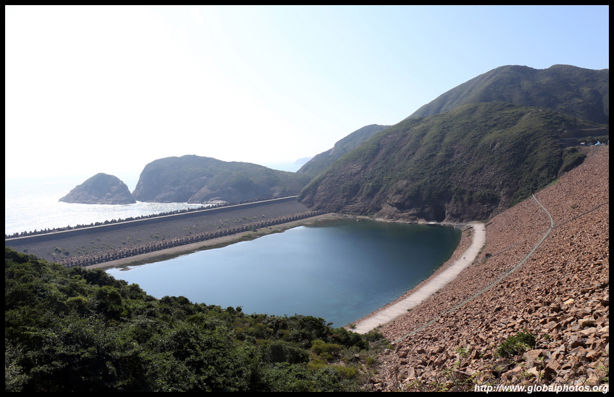
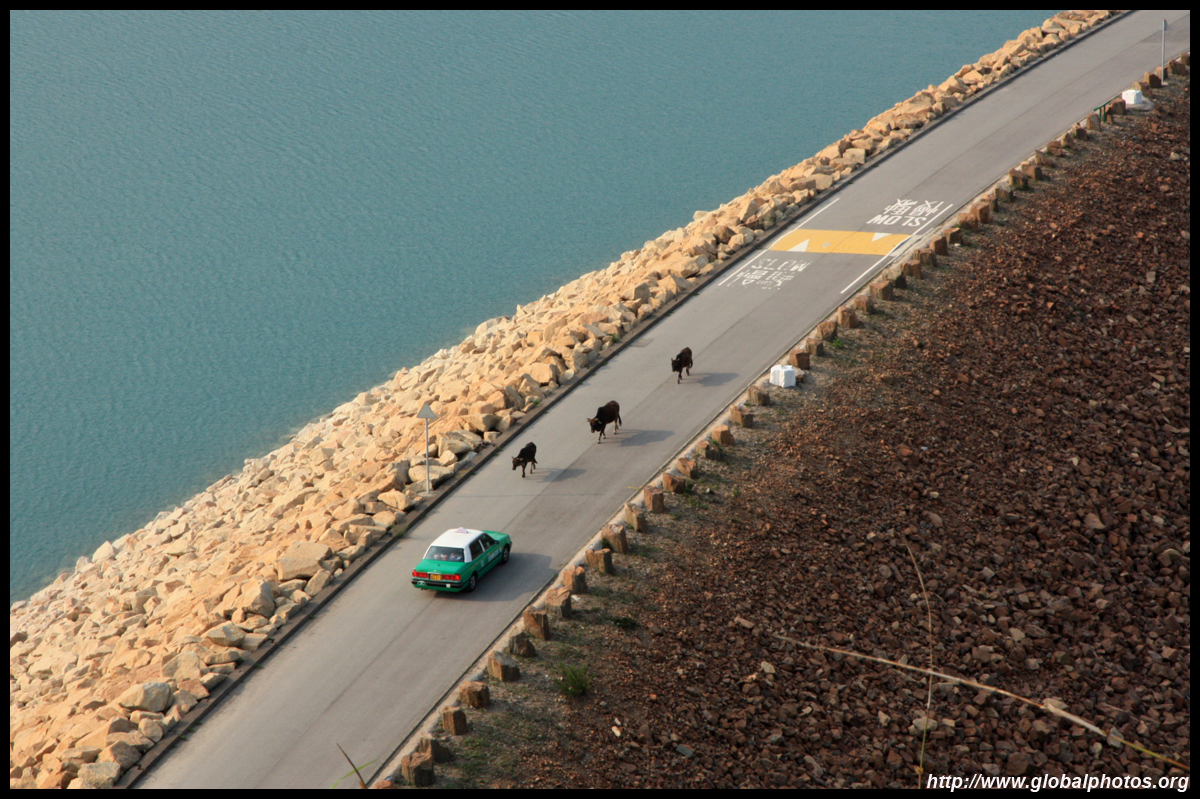
Completed in 1978, the East Dam is a popular weekend outing as it is the start of a popular hiking trail. Access is primarily by taxi, which costs about HKD$120 from Sai Kung town centre. On Sunday afternoons, there is a limited afternoon minibus service back into town as well. Getting a taxi back can be a major problem on weekends so do this walk as early as possible to avoid getting caught in the crowd. If you don't mind a very long walk, you can take a bus to Pak Tam Chung and then walk the remaining 10km.
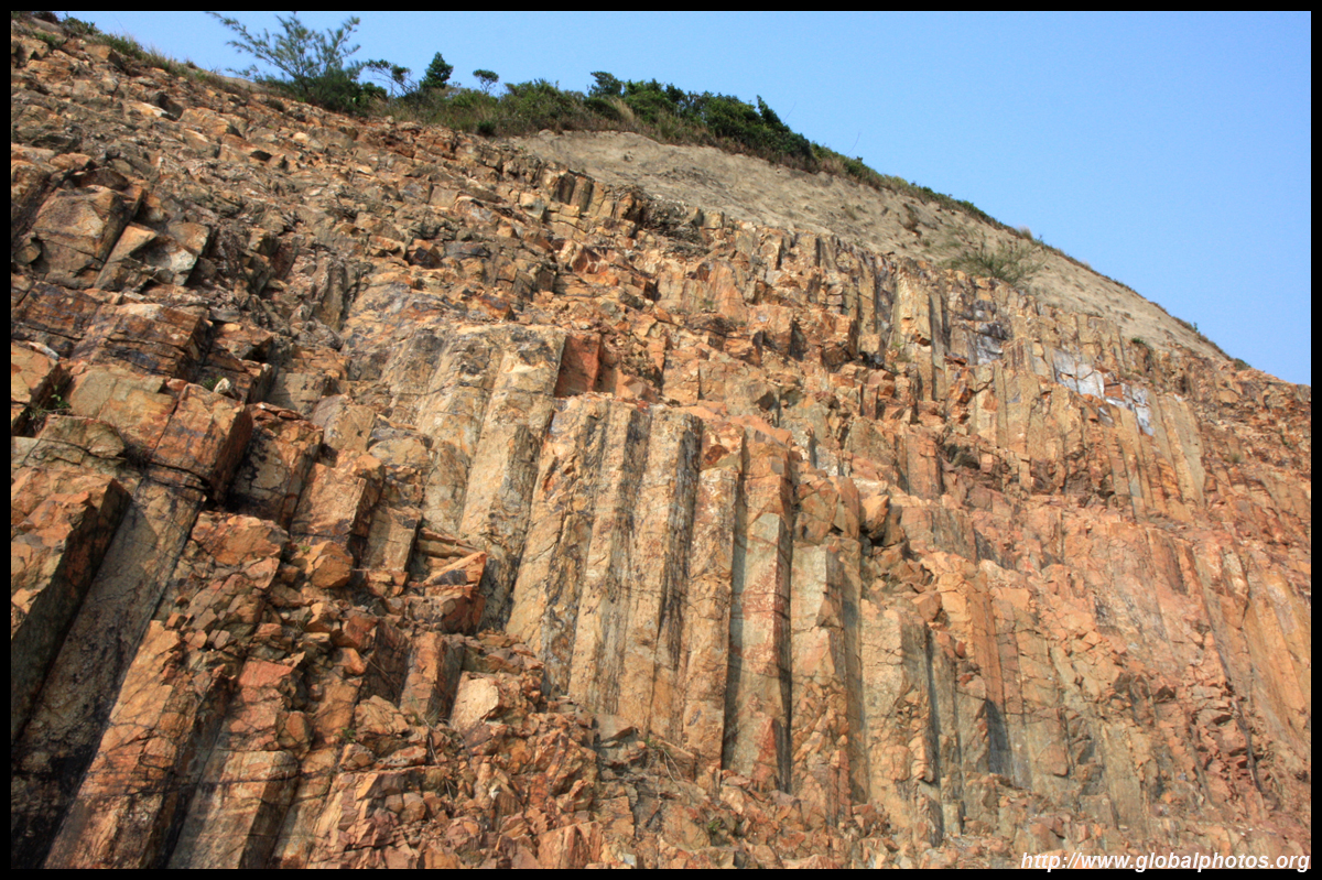
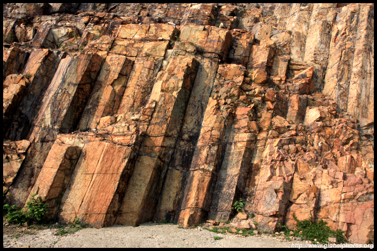
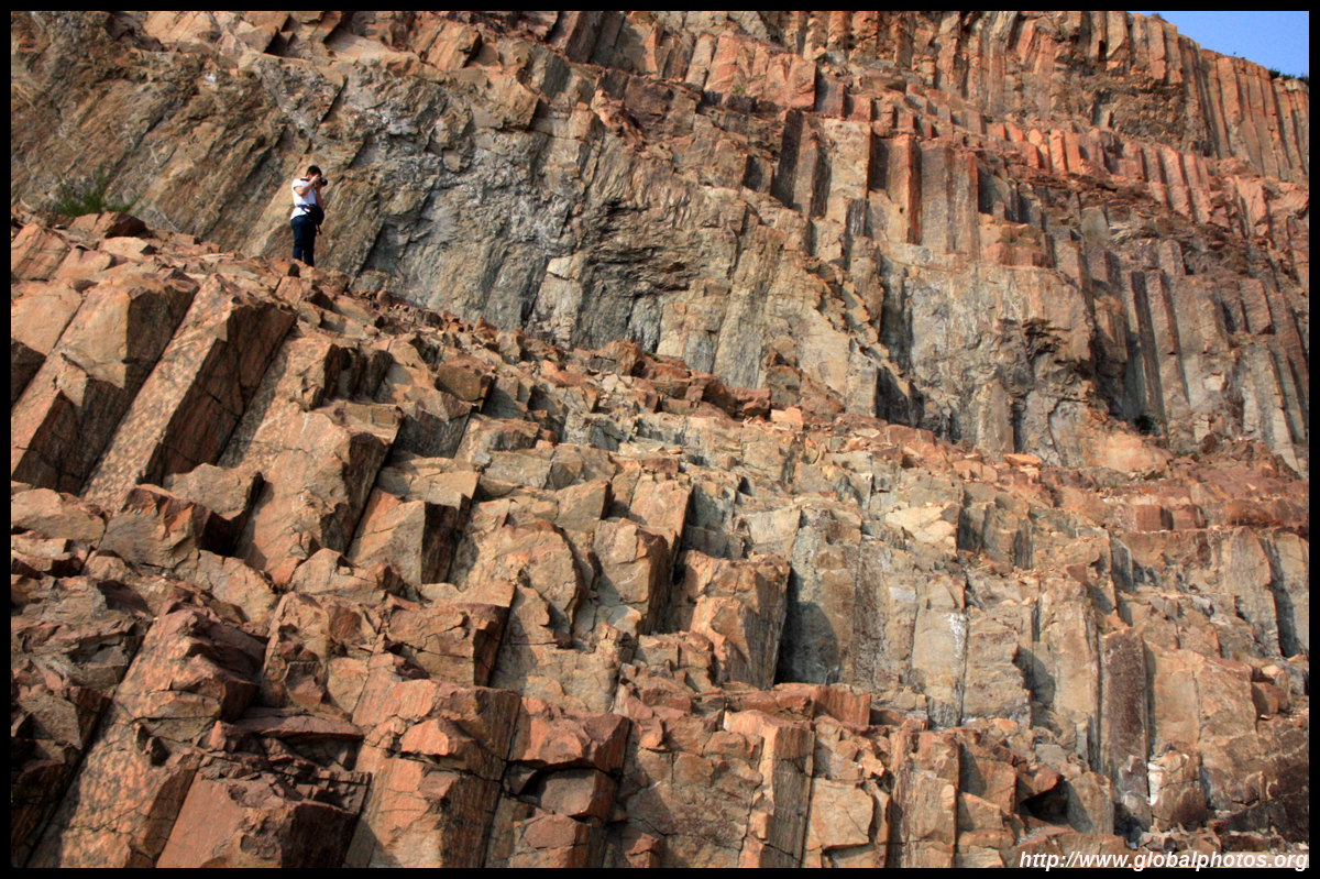
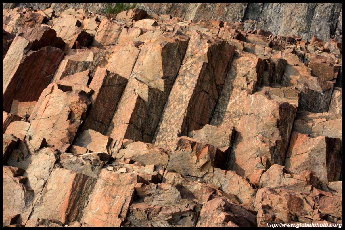
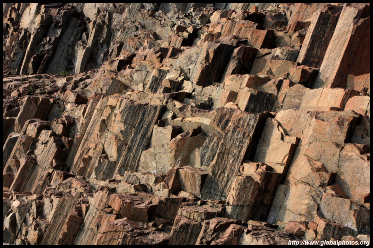
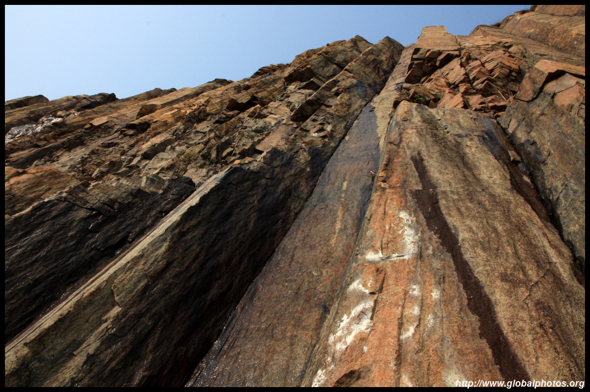
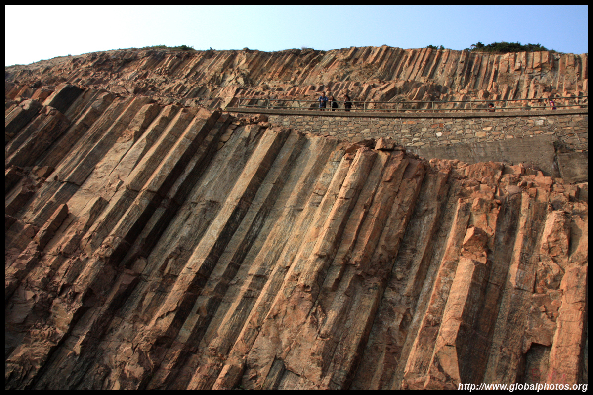
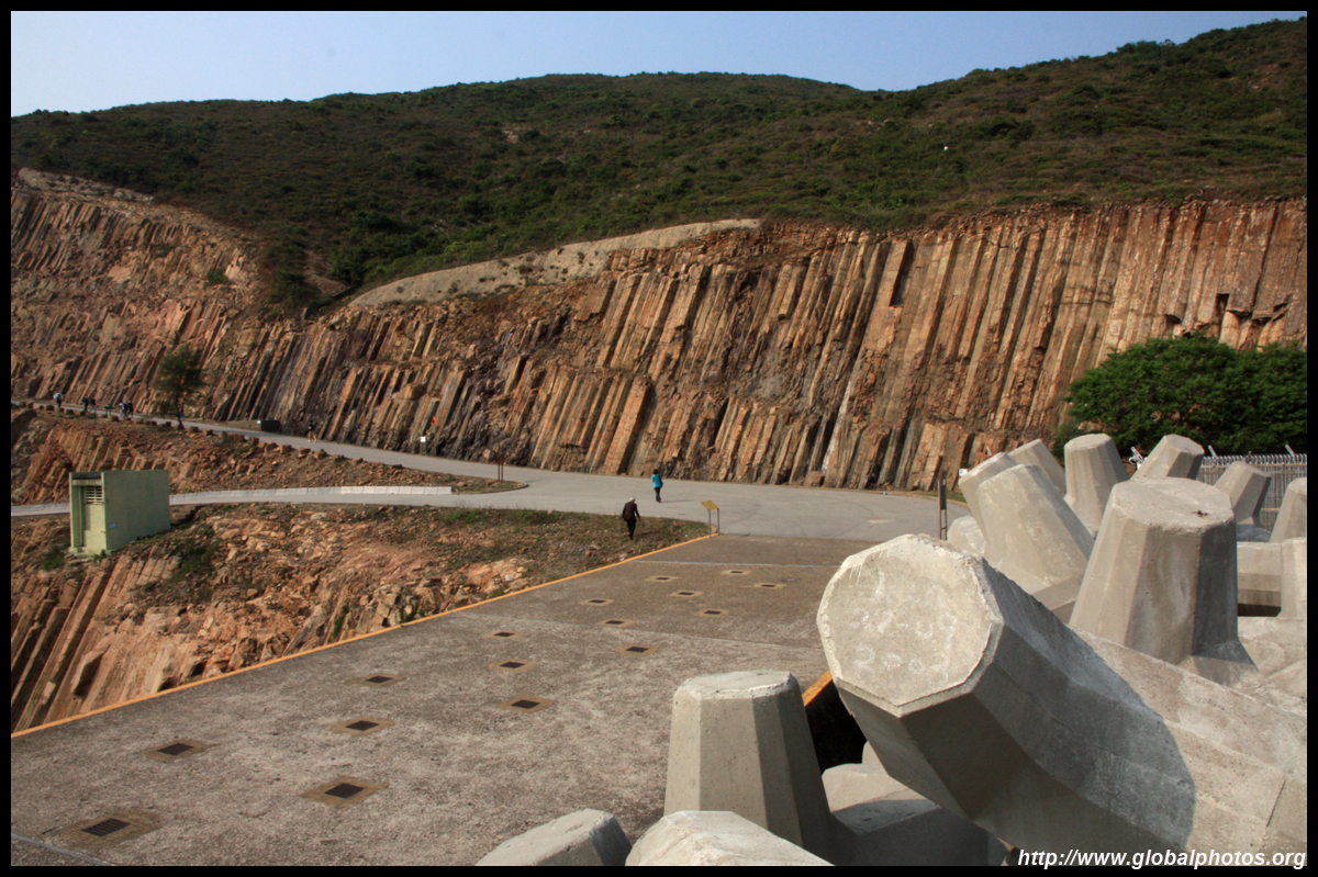
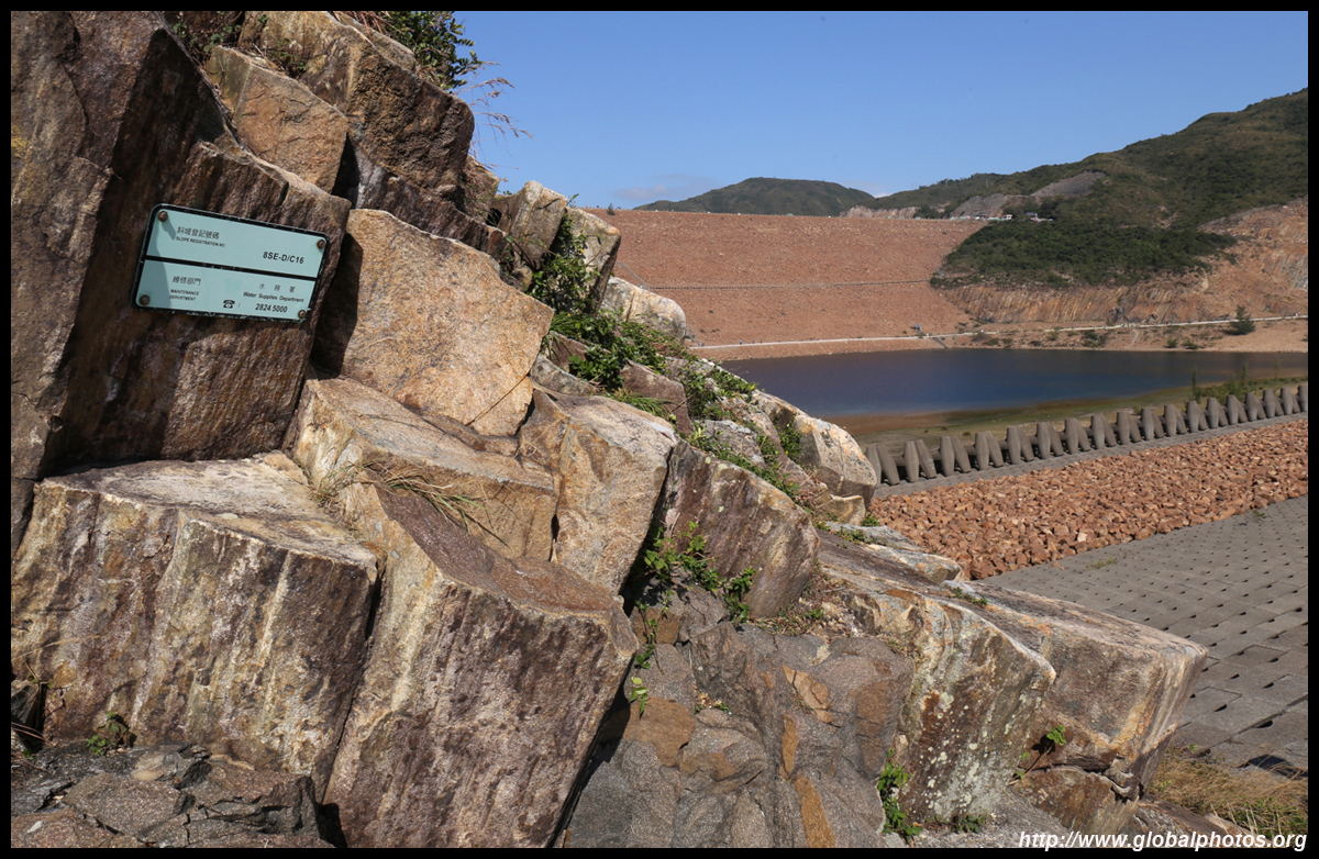
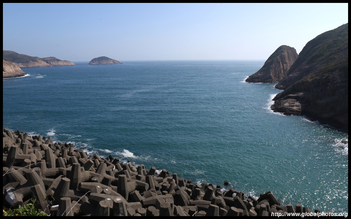
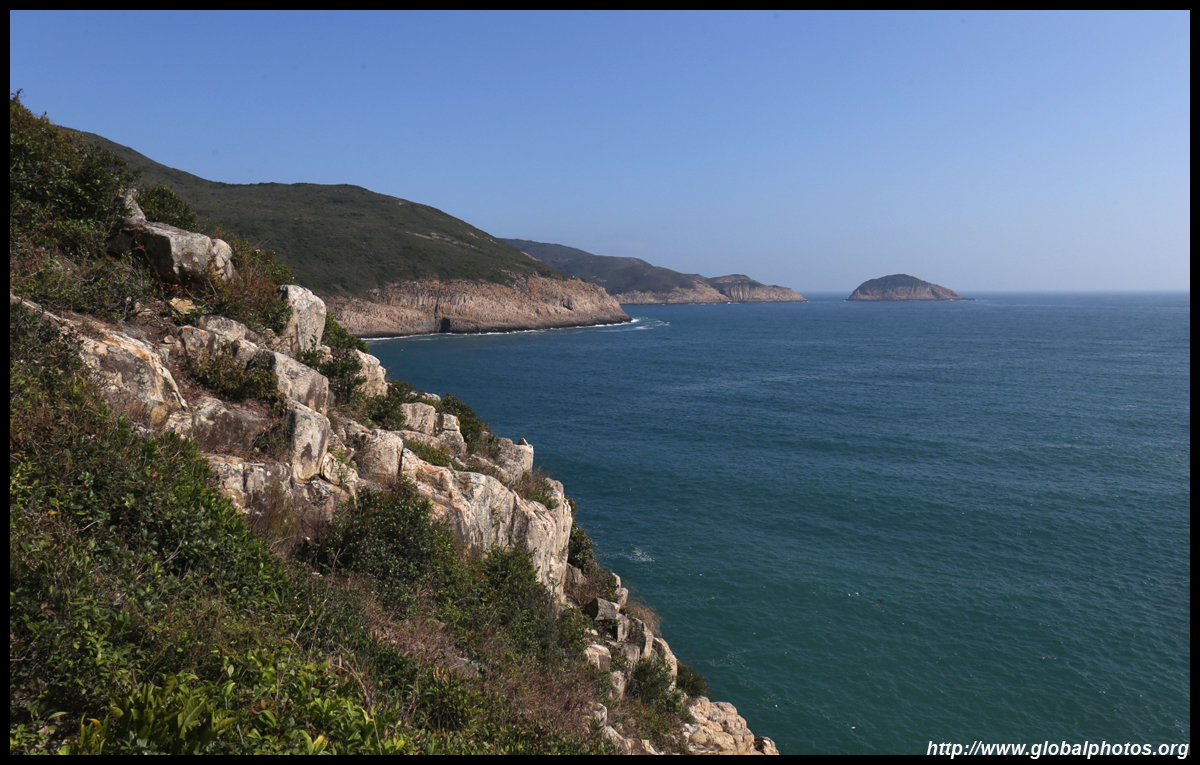
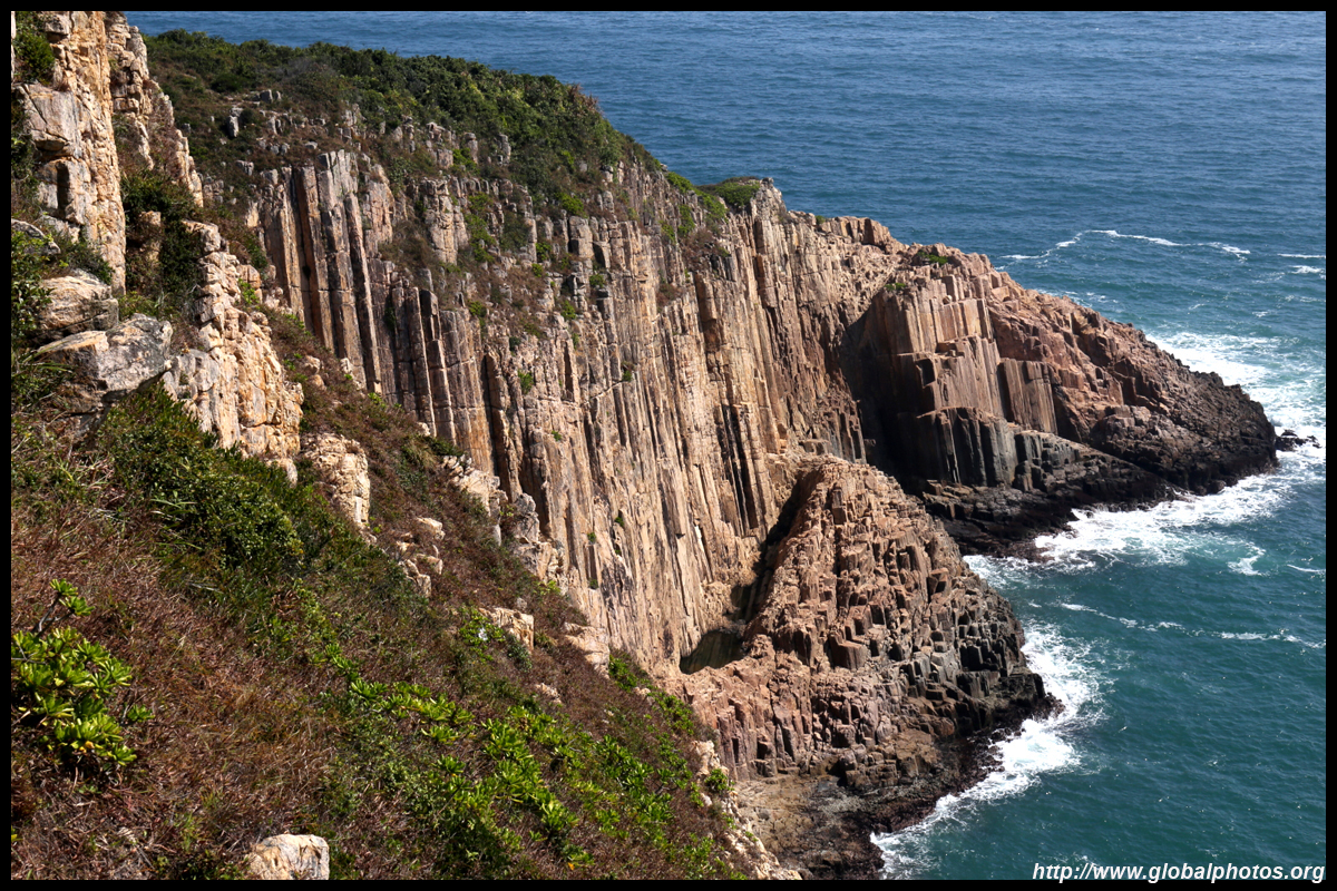
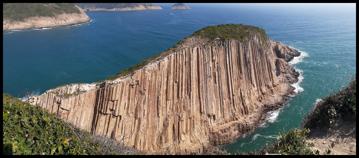
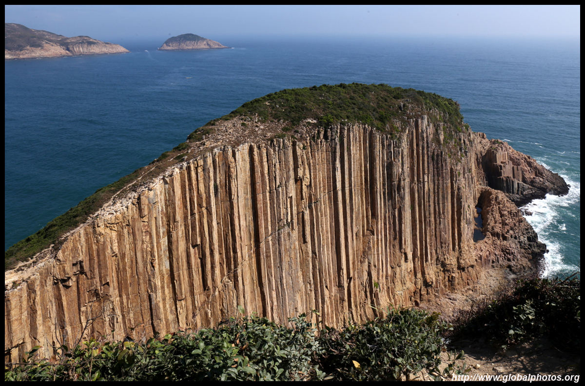
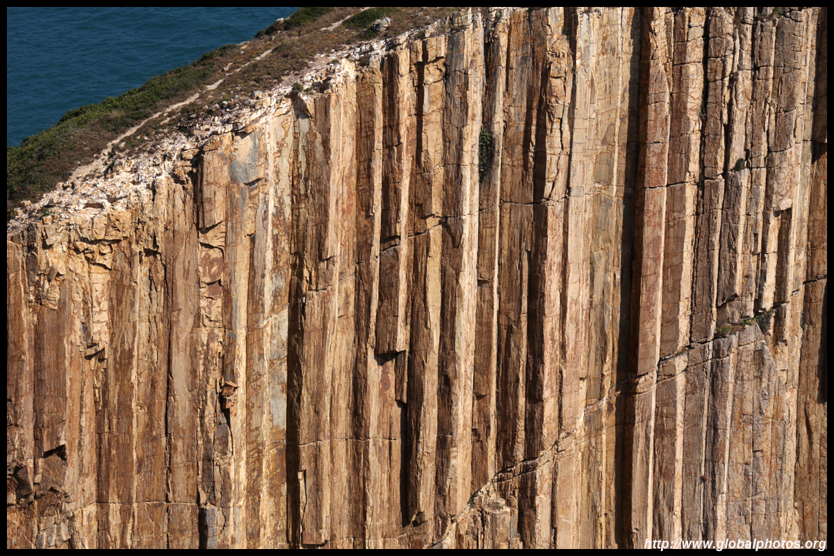
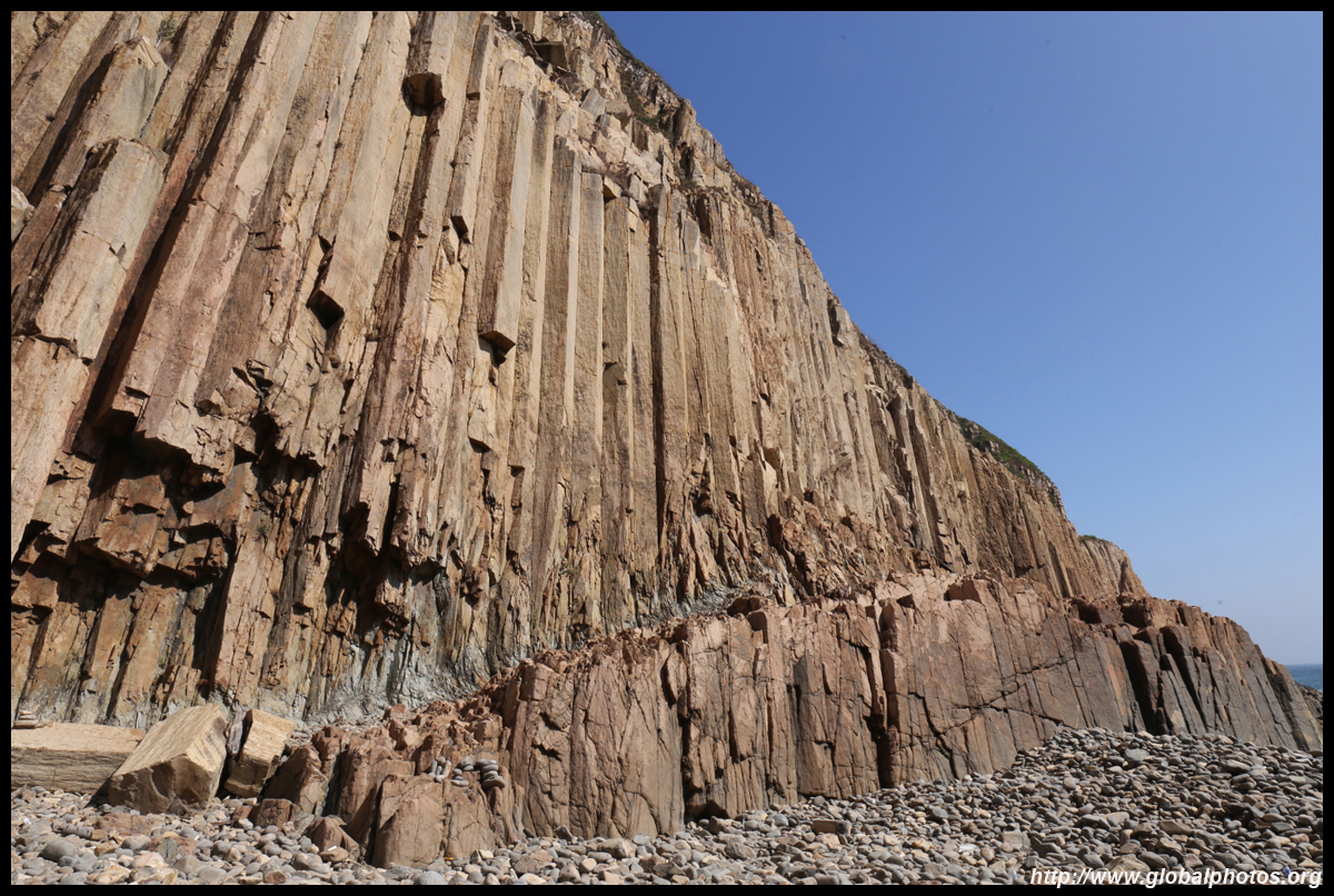
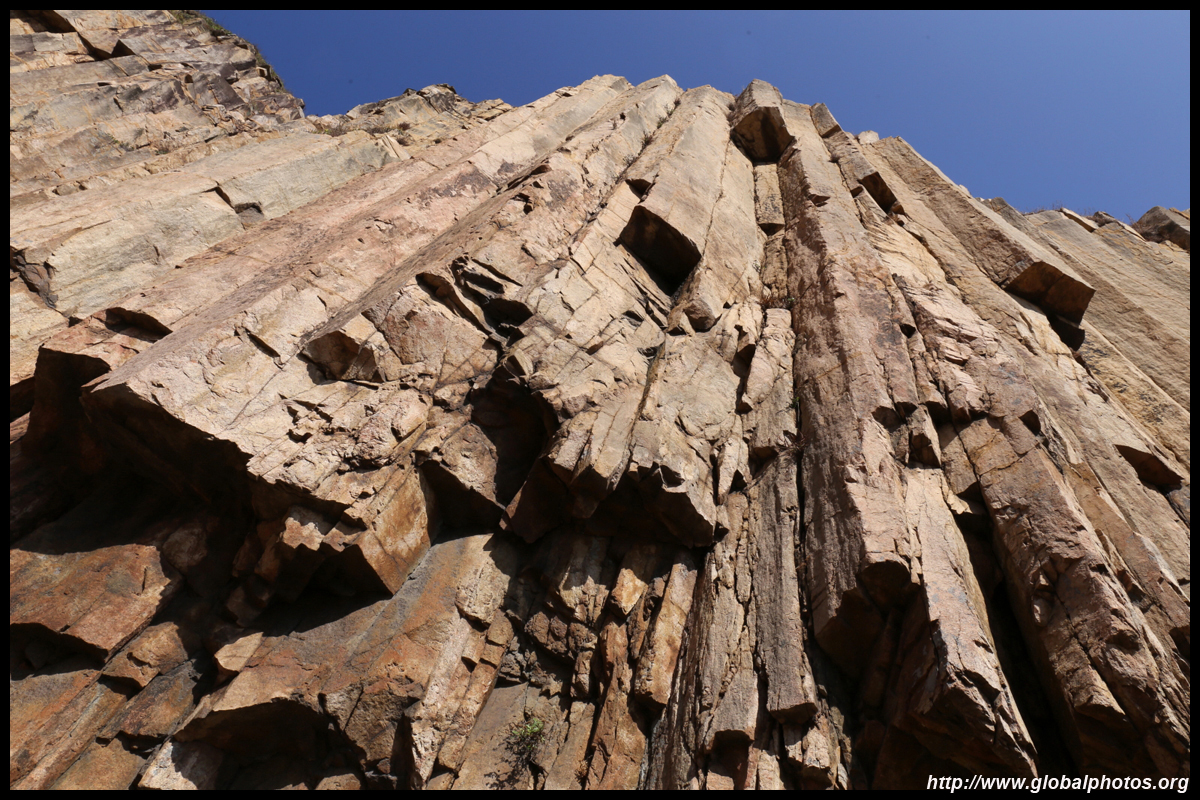
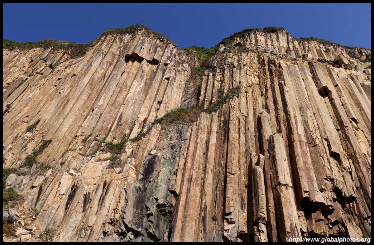
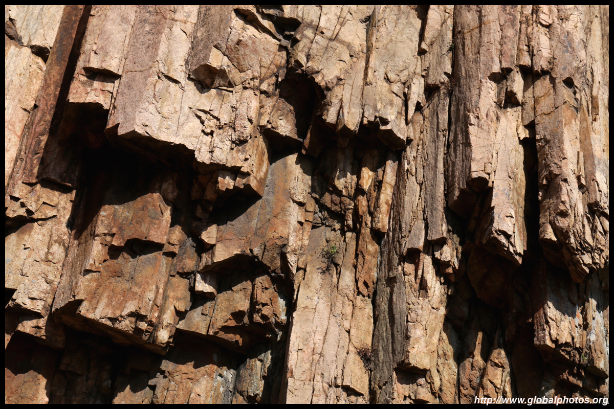
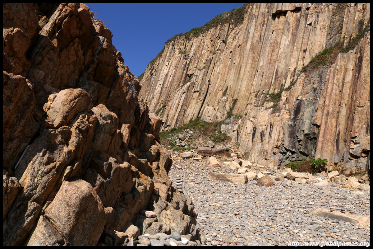
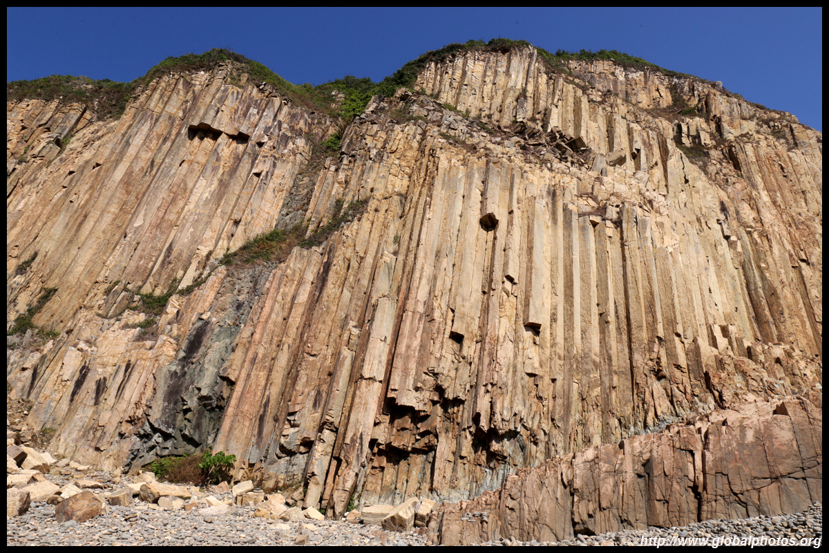
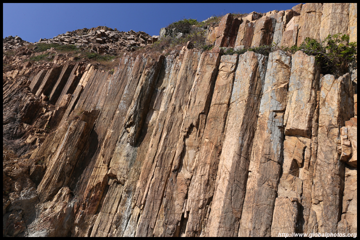
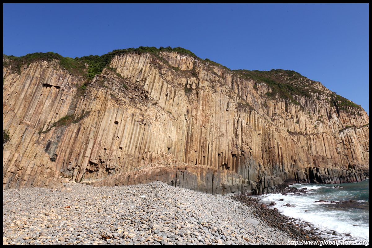
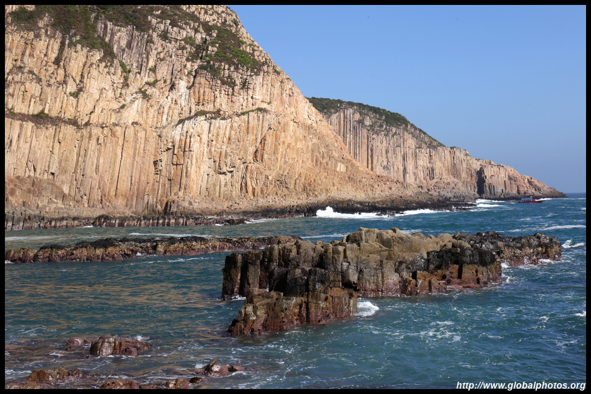
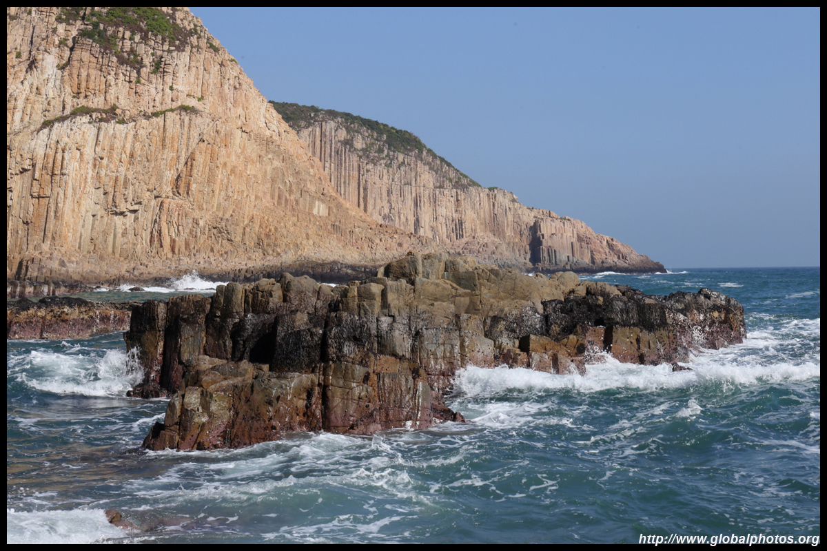
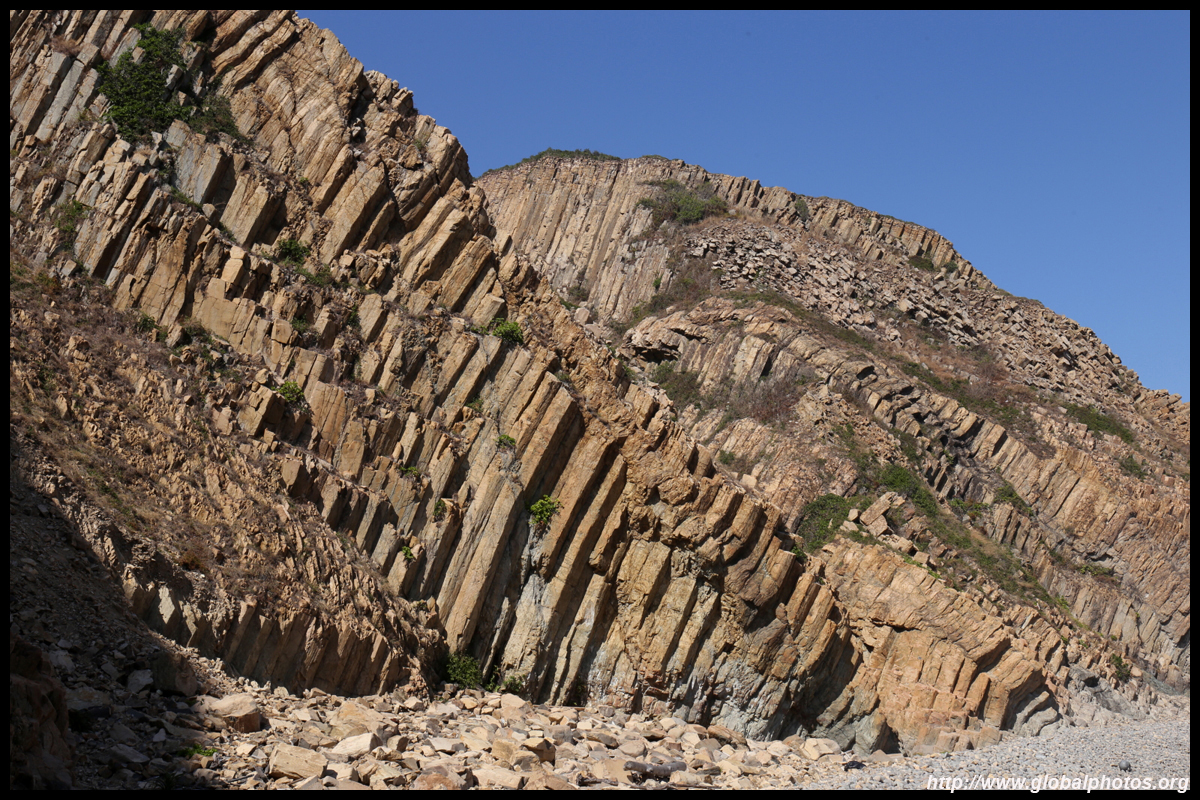
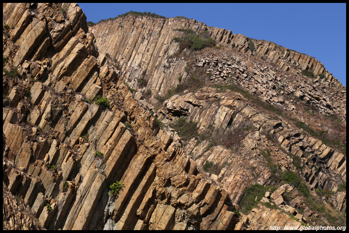
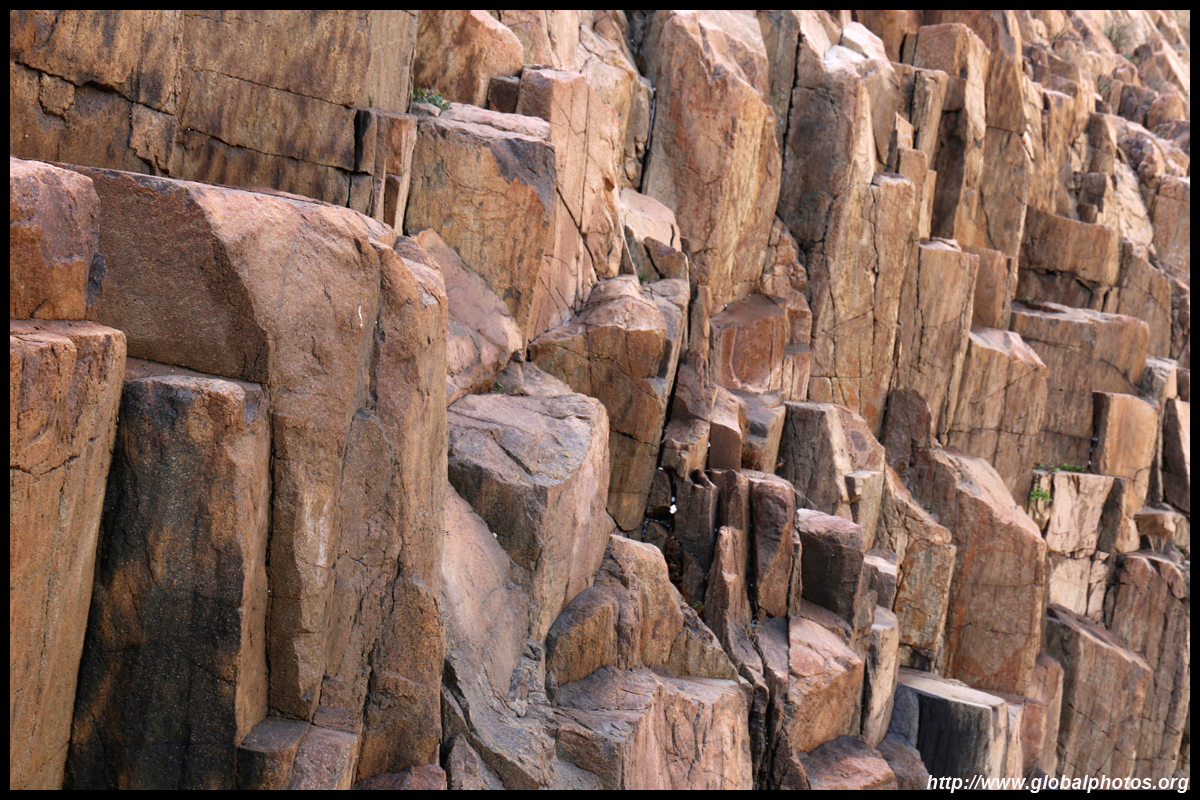
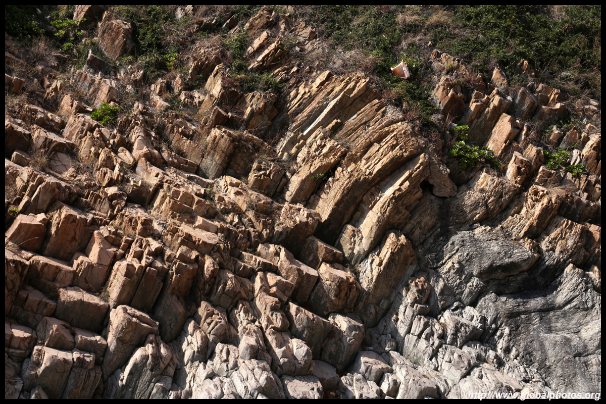
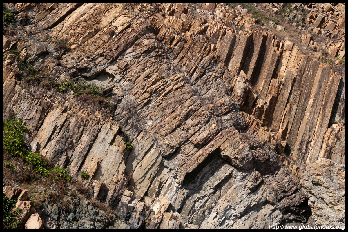
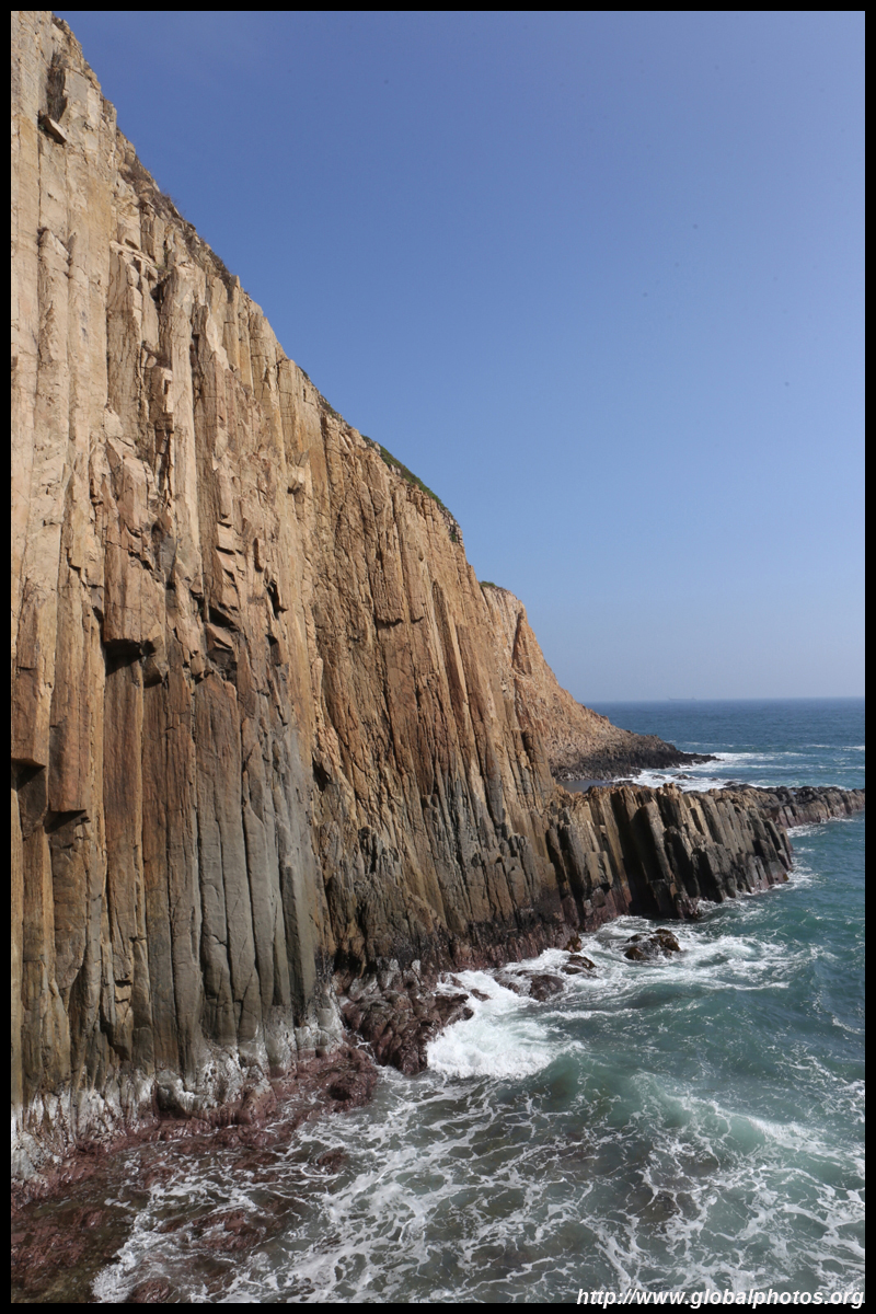
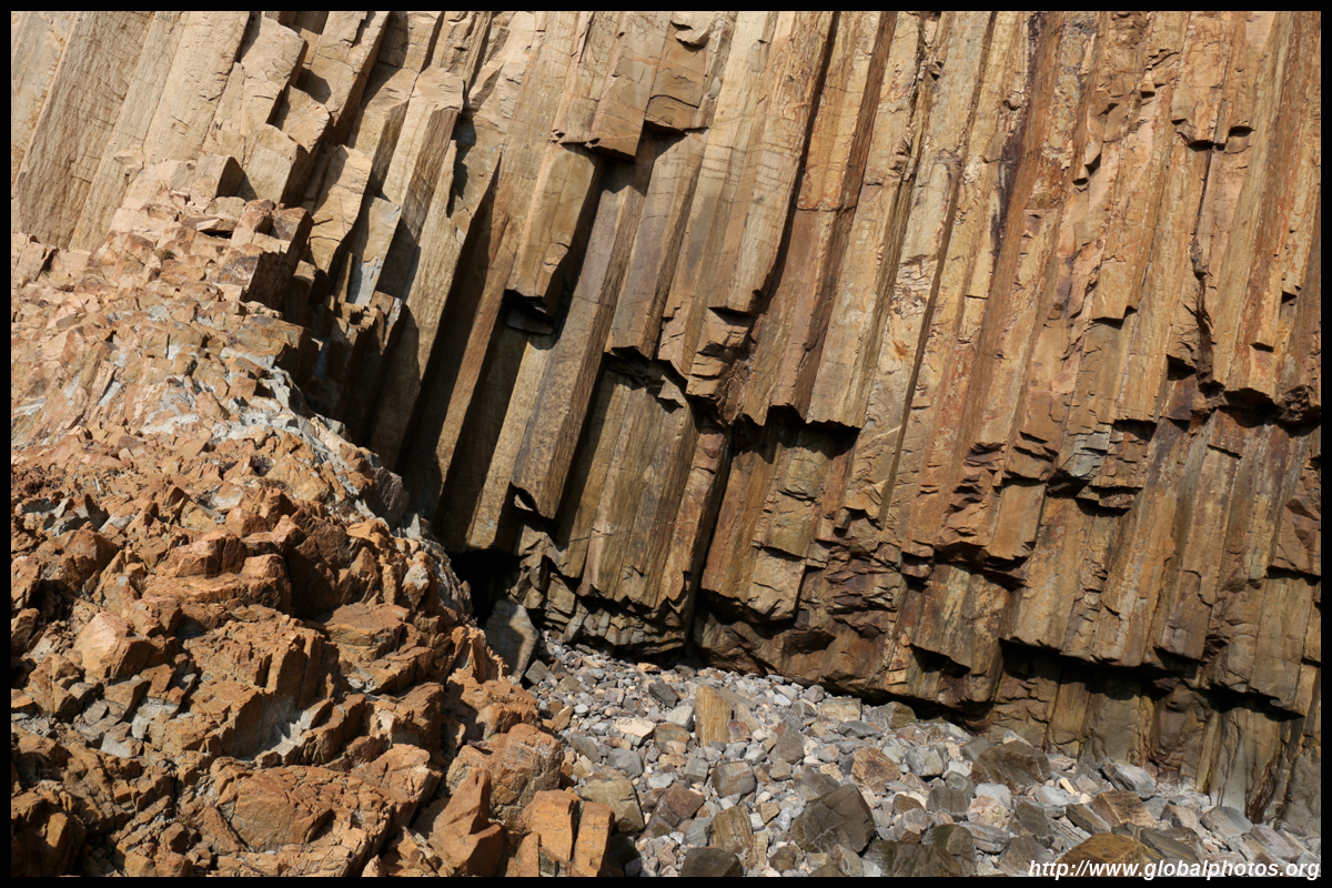
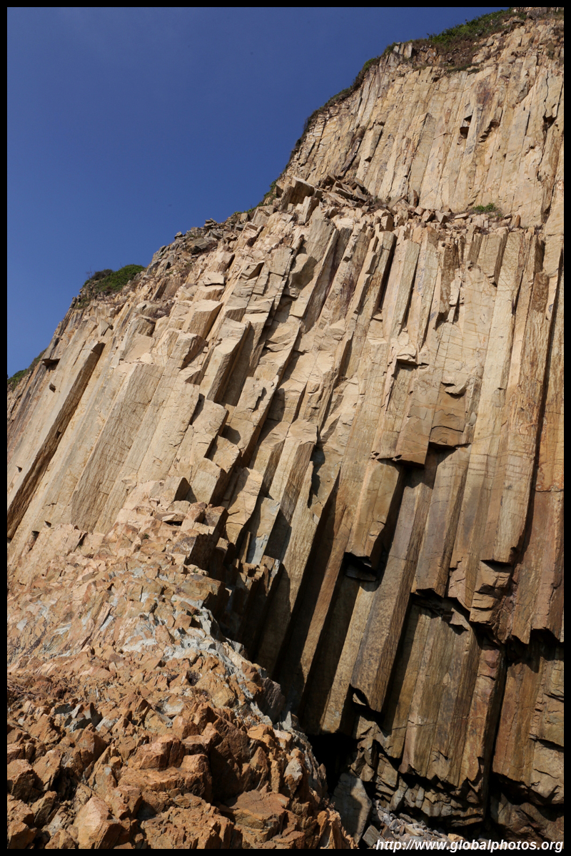
This section is part of the Hong Kong UNESCO Global Geopark that was created in 2015. 85% of Hong Kong's land was formed by volcanic eruptions, creating these spectacular settings that we enjoy today. While many come for the MacLehose Trail to Long Ke, don't forget to see some interesting hexagonal rock formations around the dam with some light hiking to a few offshoot sites that can easily take up a half day. Get off the taxi at the end of the dam, where there is a roundabout and public toilets. Walk downhill along the paved road to the sea barrier. You will see volcanic columns can reach as high as 30m tall that were formed 140 million years ago to your left.
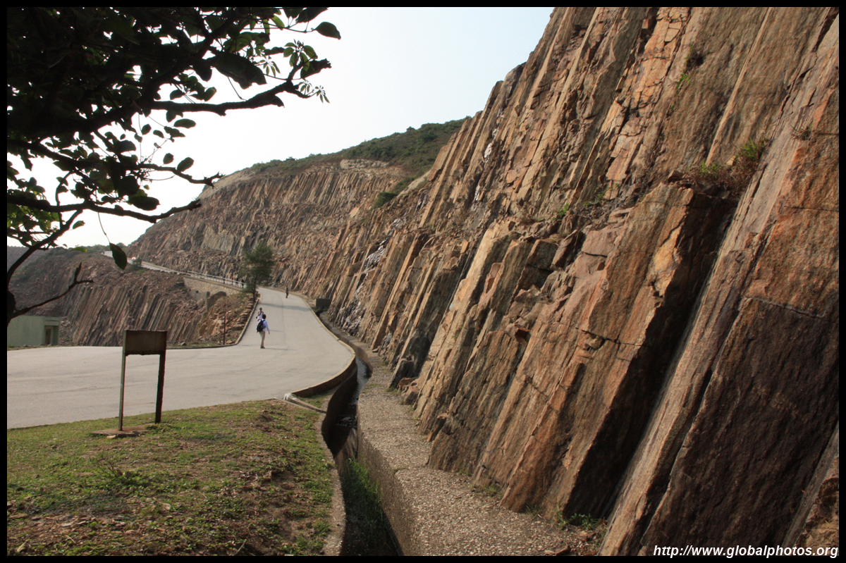
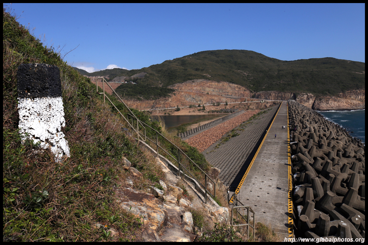
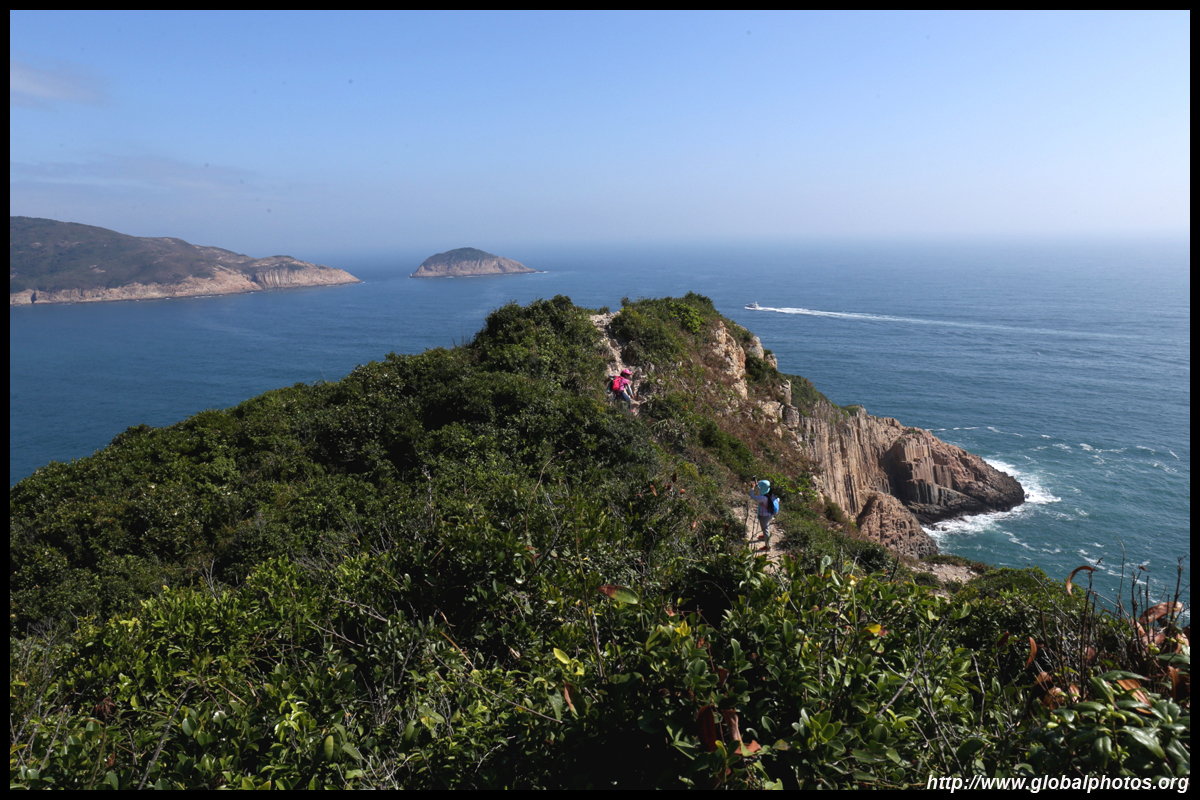
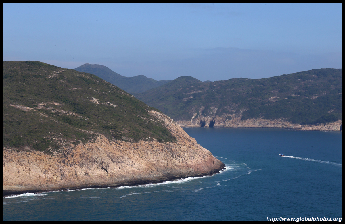
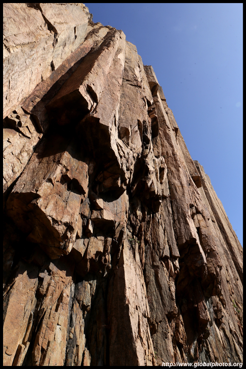
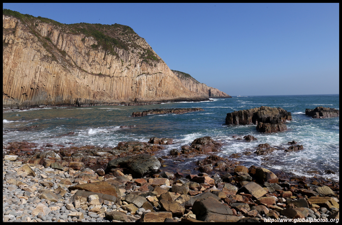
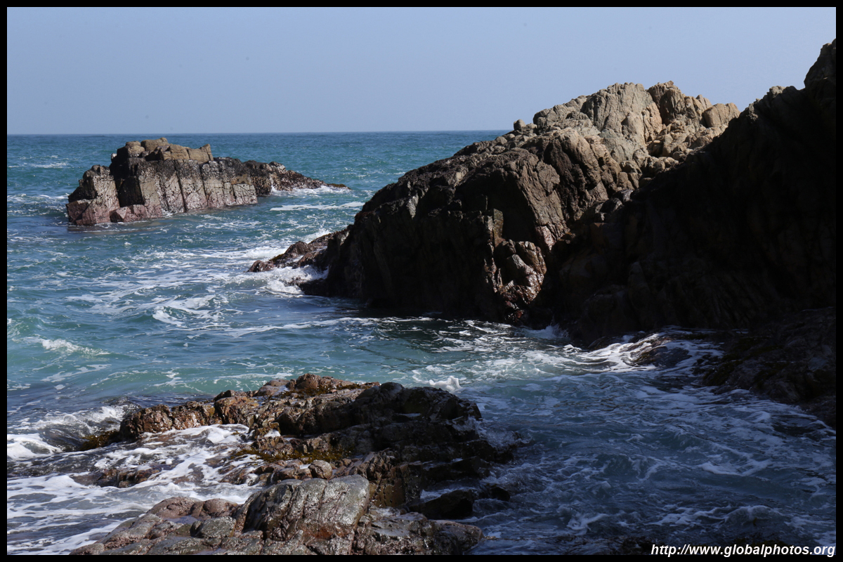
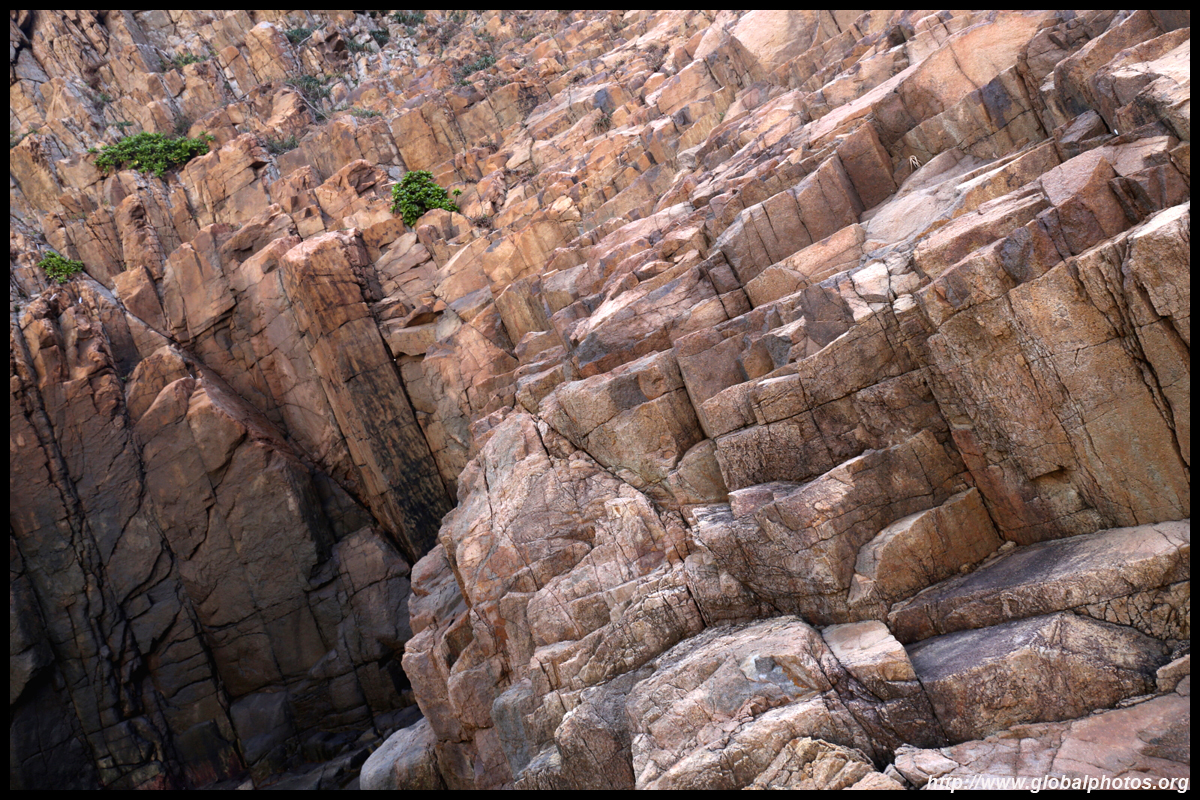
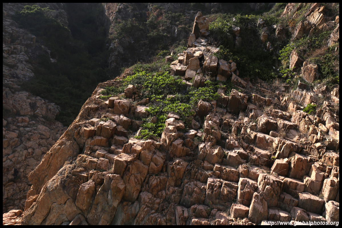
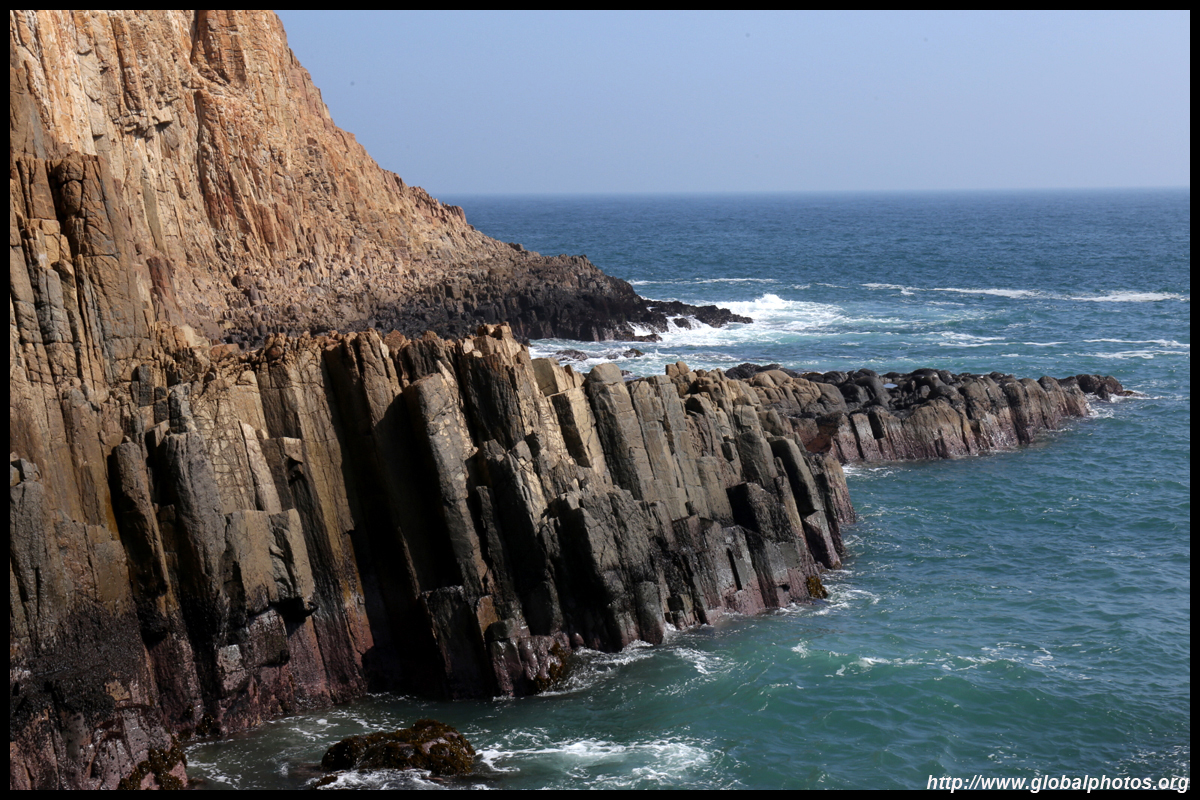
Just off the dam is an island with a sliced-off face. Po Pin Chau is accessible by a short hike from the dam. You can either go back up to the main dam and walk across to the other side to access a path uphill.
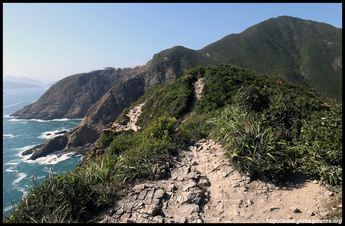
The other way up starts at the end of the lower sea barrier. You can climb along the fence to the hill to start the hike, which is a bit dangerous. Or next to the landslide warning sign on your right, climb up along the water drainage viaduct to connect to the trail. This route is actually much shorter.
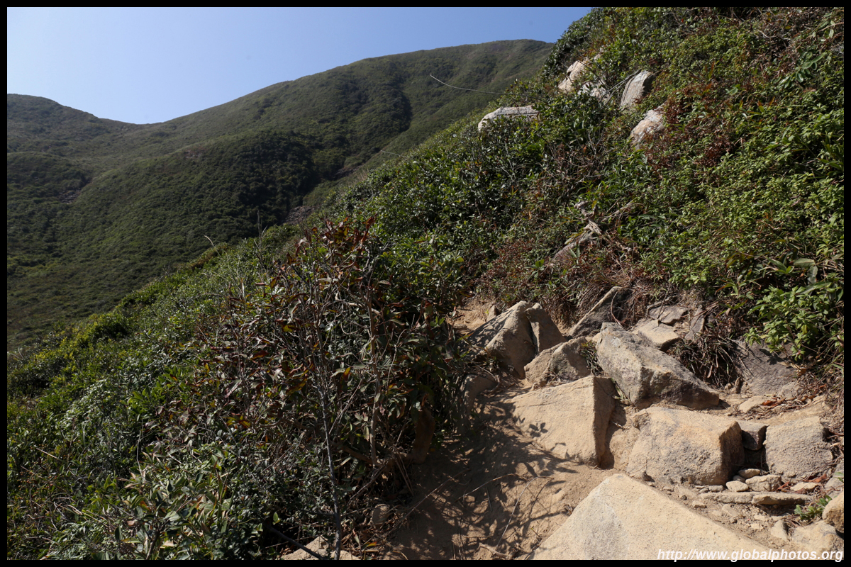
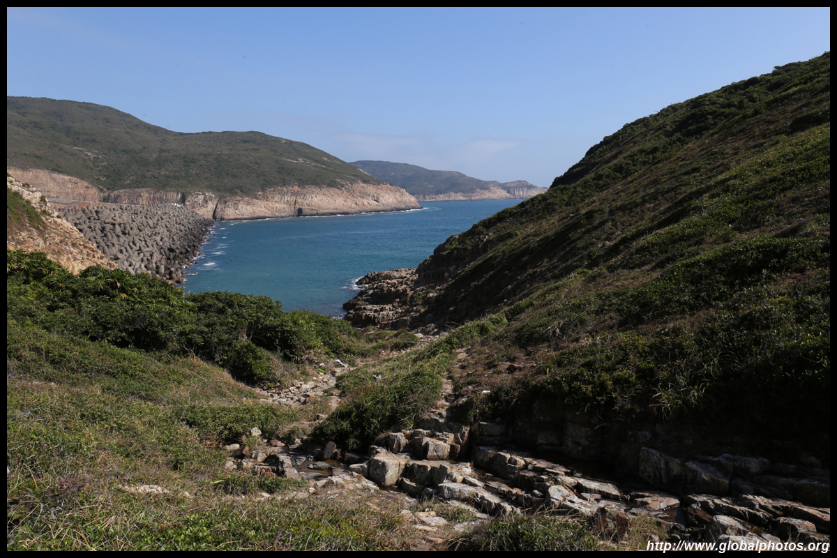
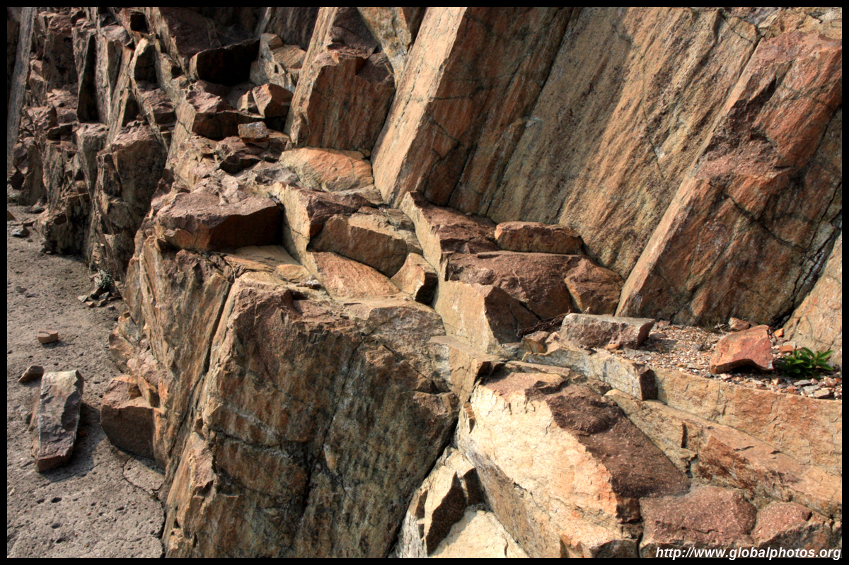
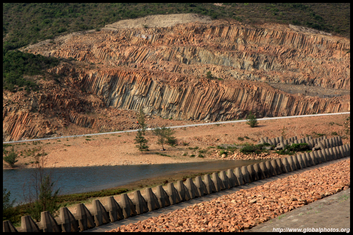
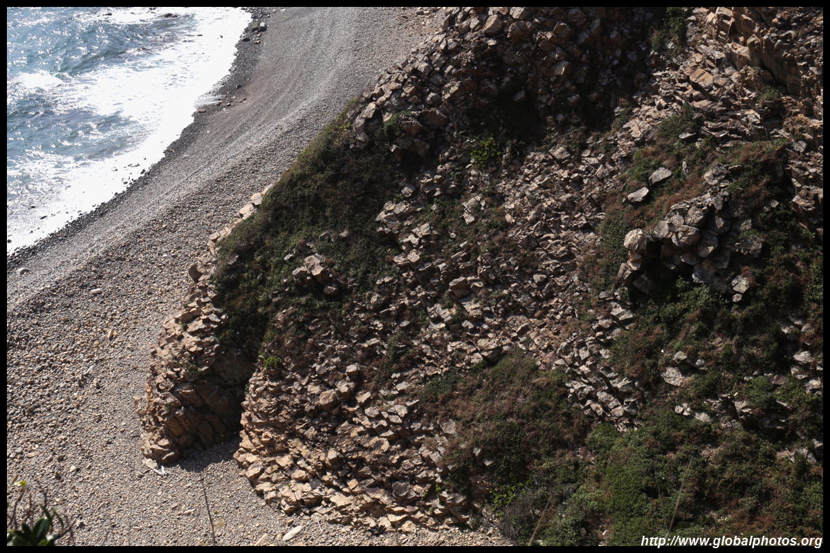
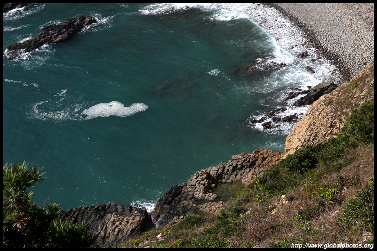
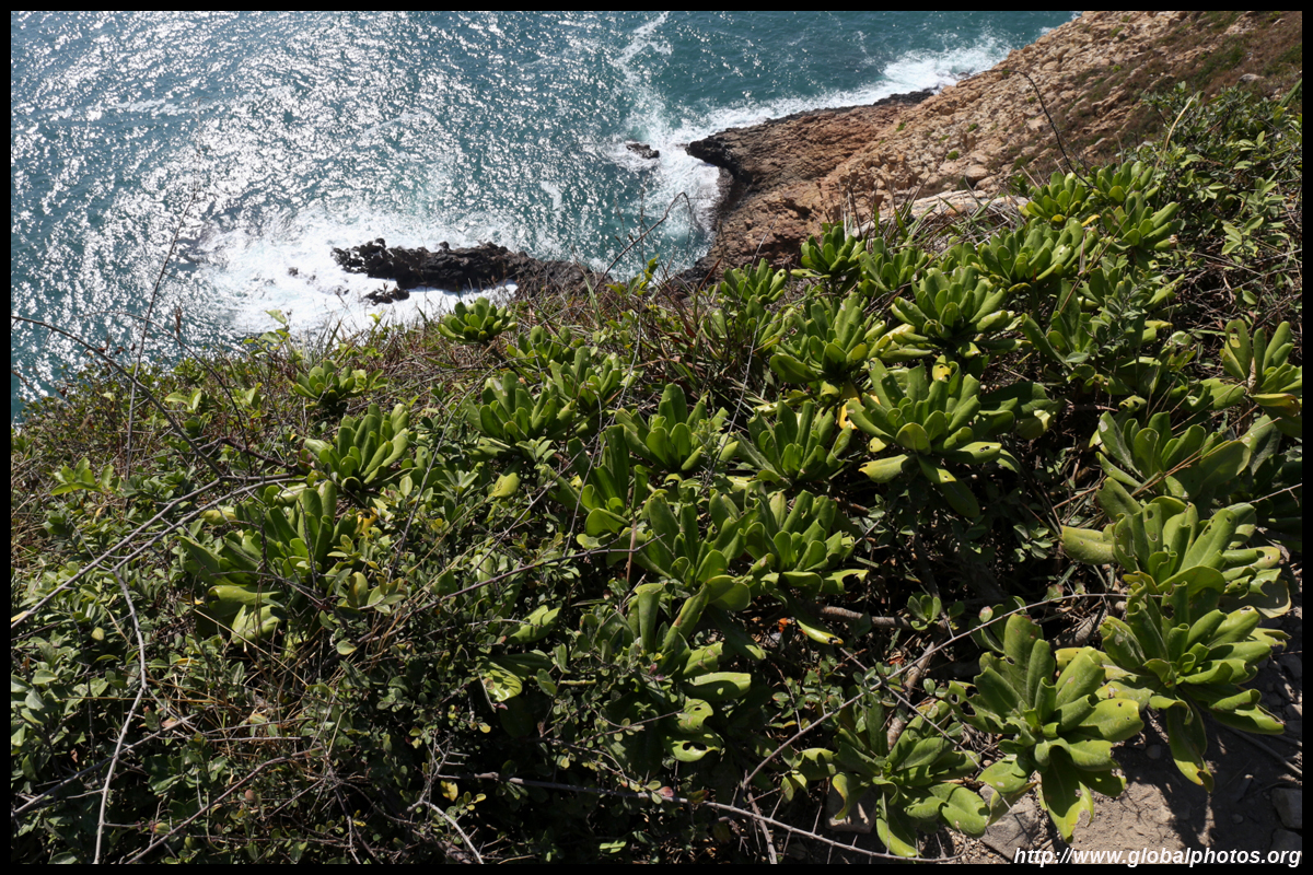
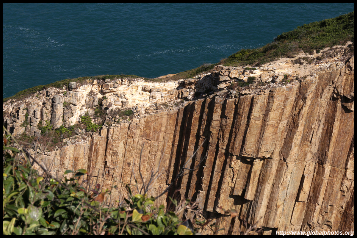
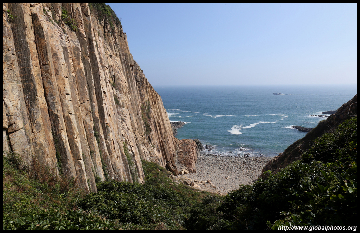
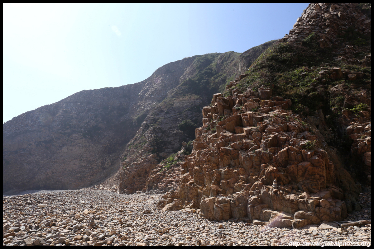
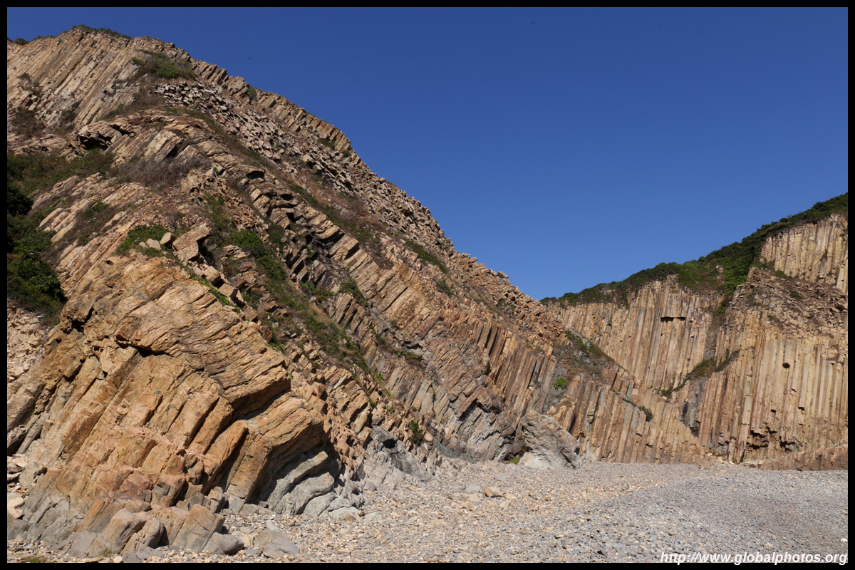
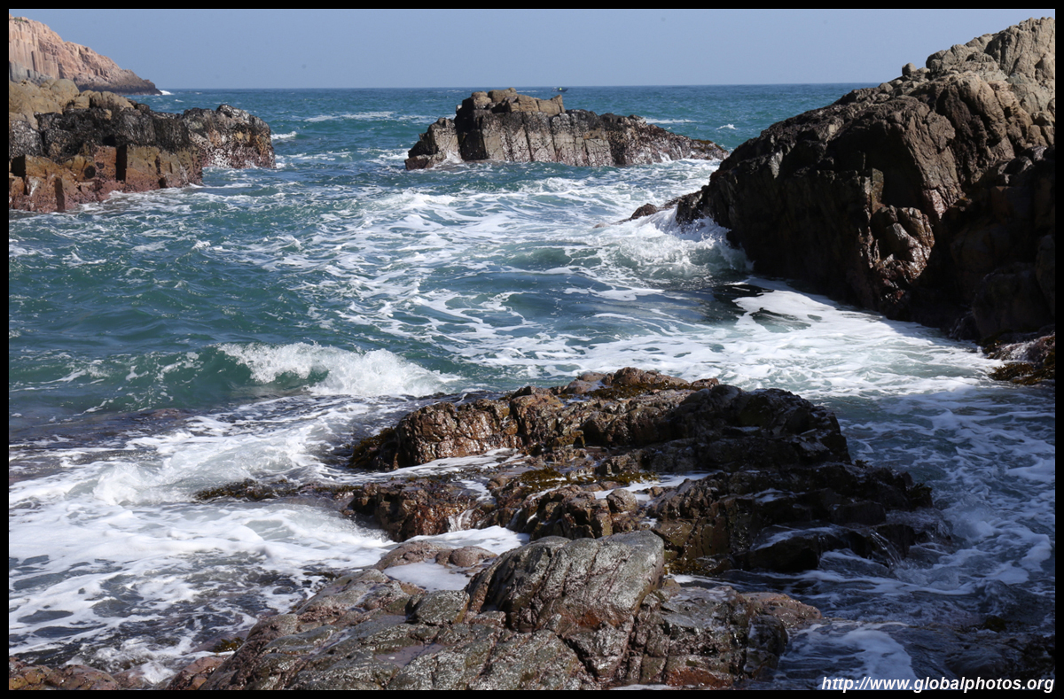
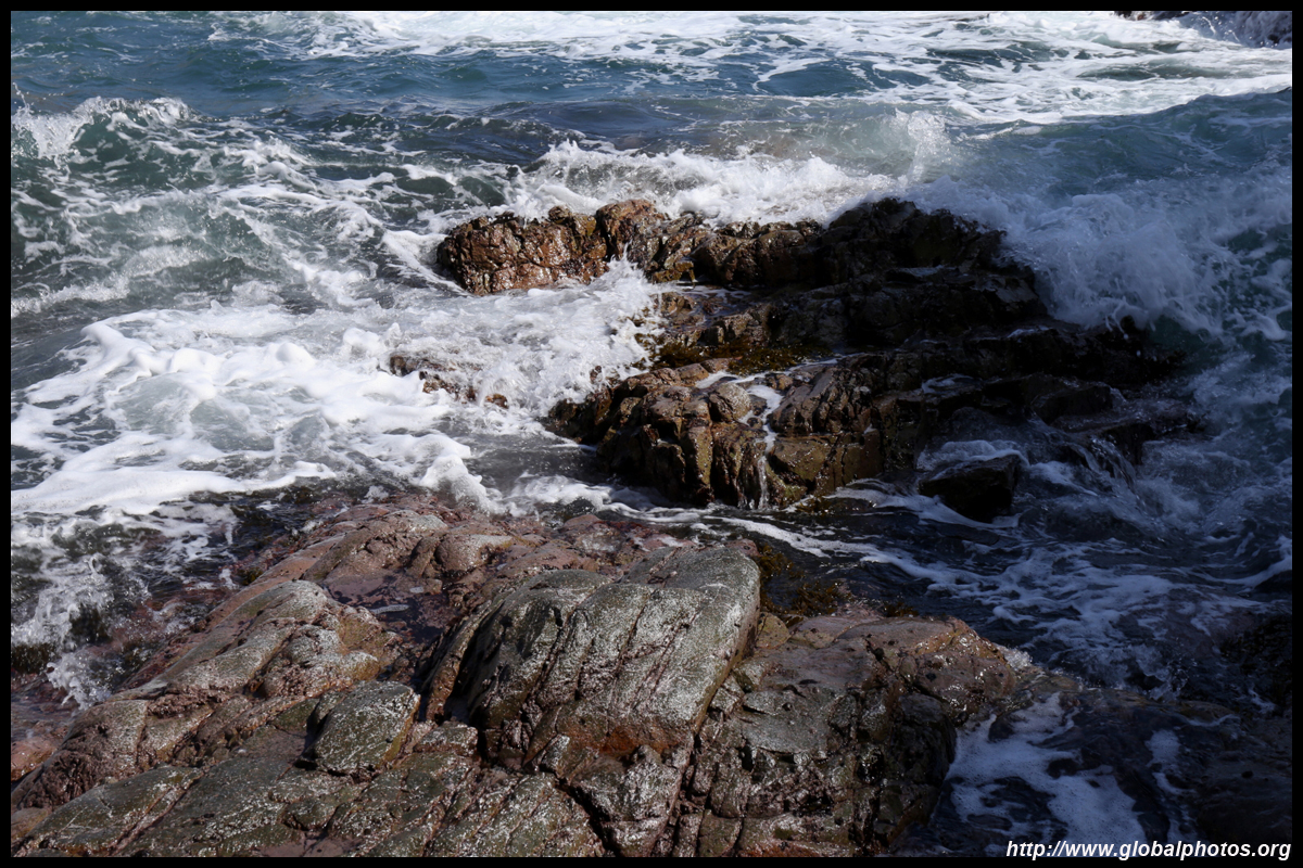
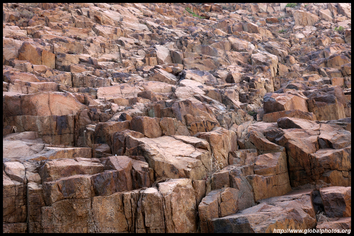
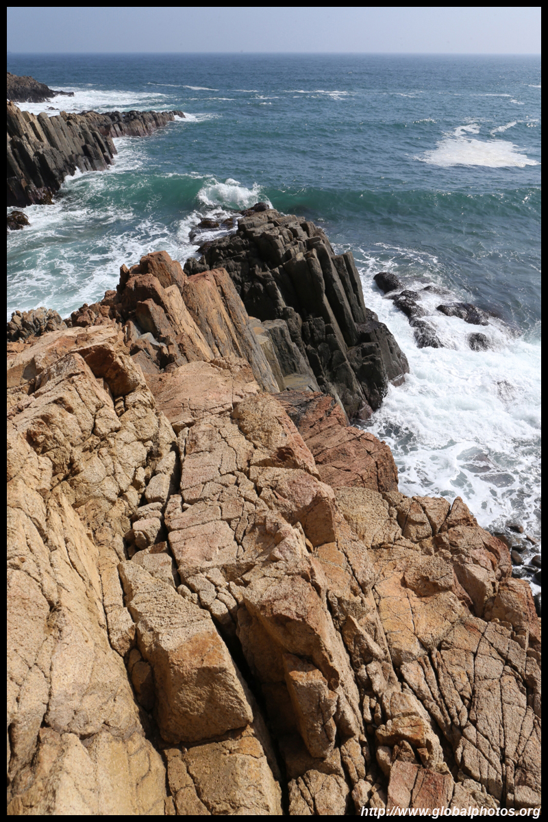
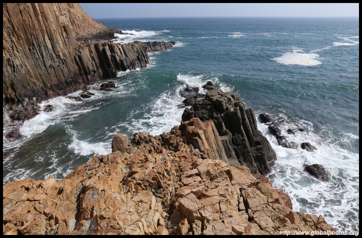
As you hike up to the cliff edge for a view of Po Pin Chau, you will see more interesting rocks to your right towards Kim Chu Wan.
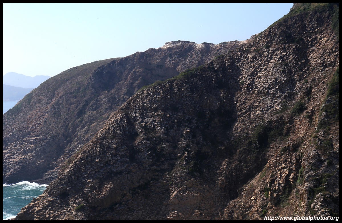
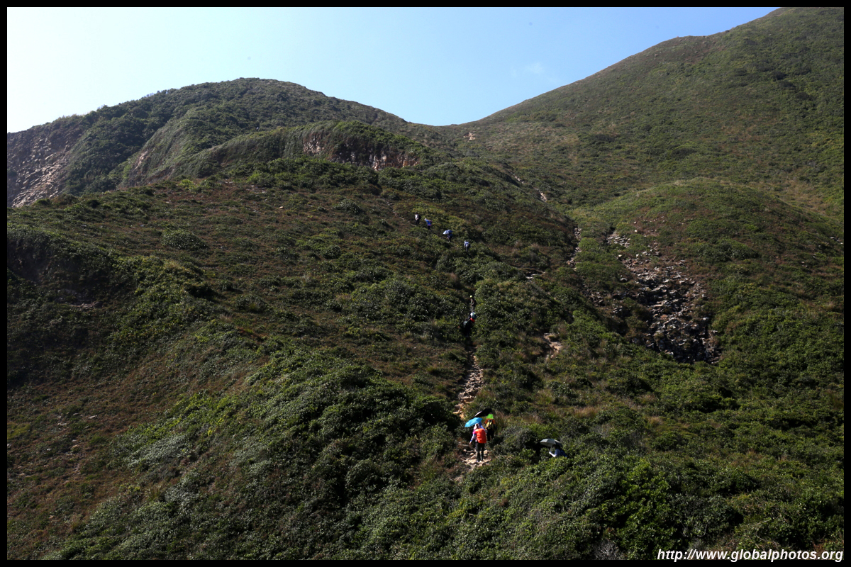
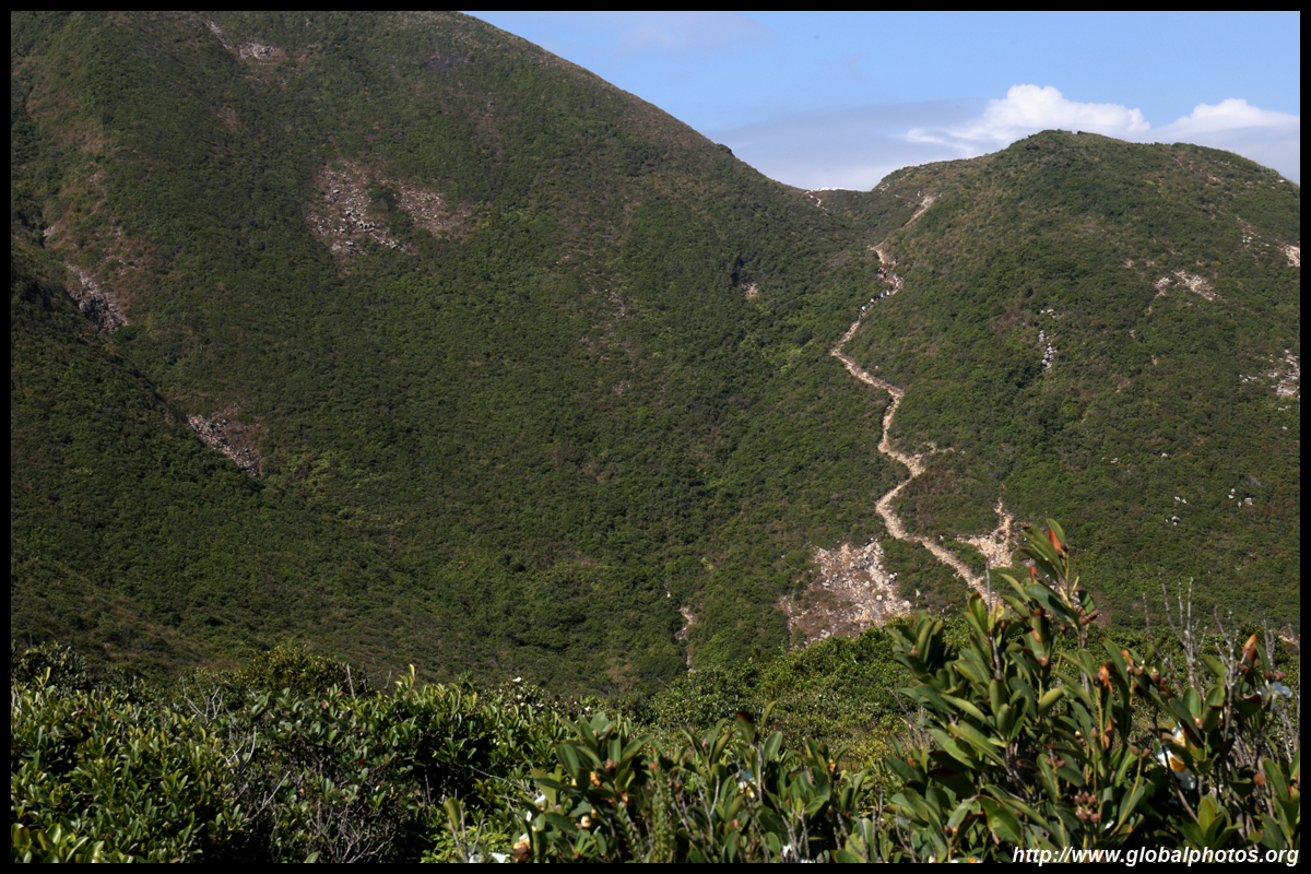
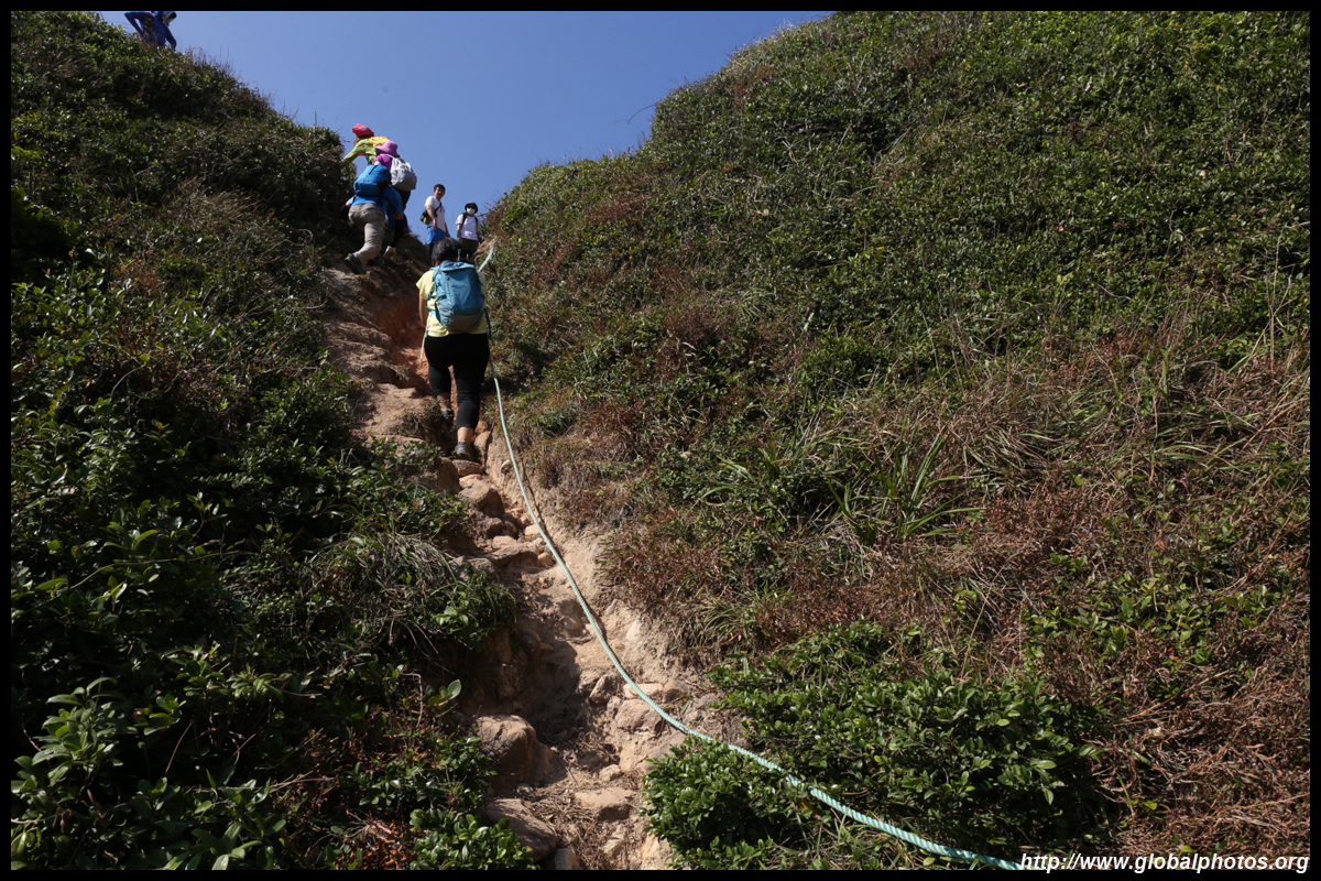
Hikers taking the first route uphill from the main dam will descend down as seen here. It looked steep in sections and the hikers moved slowly downhill.
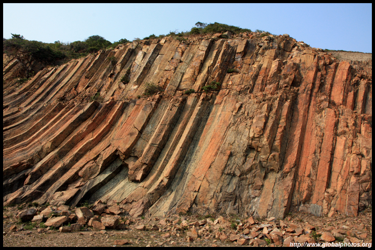
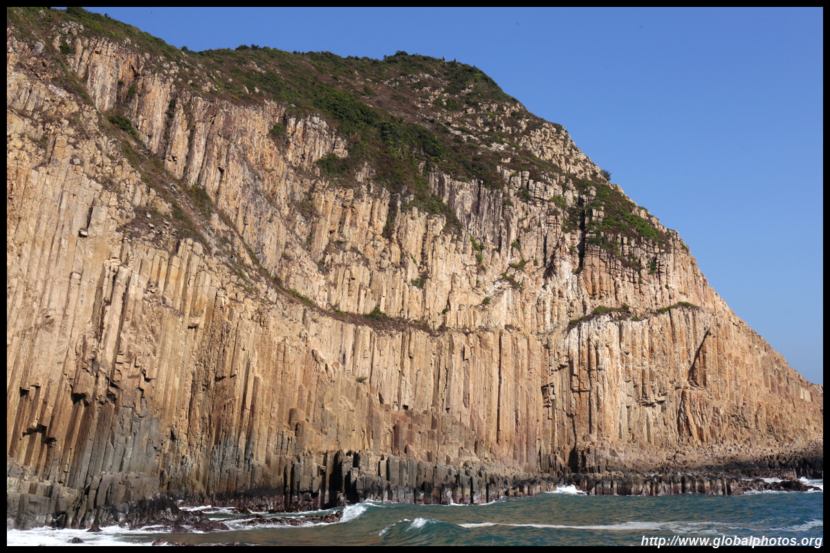
Po Pin Chau was once part of the mainland, but the sea's power separated it out and a giant pipe organ rockface emerged. The cut is almost vertical and is best seen from the mainland side.
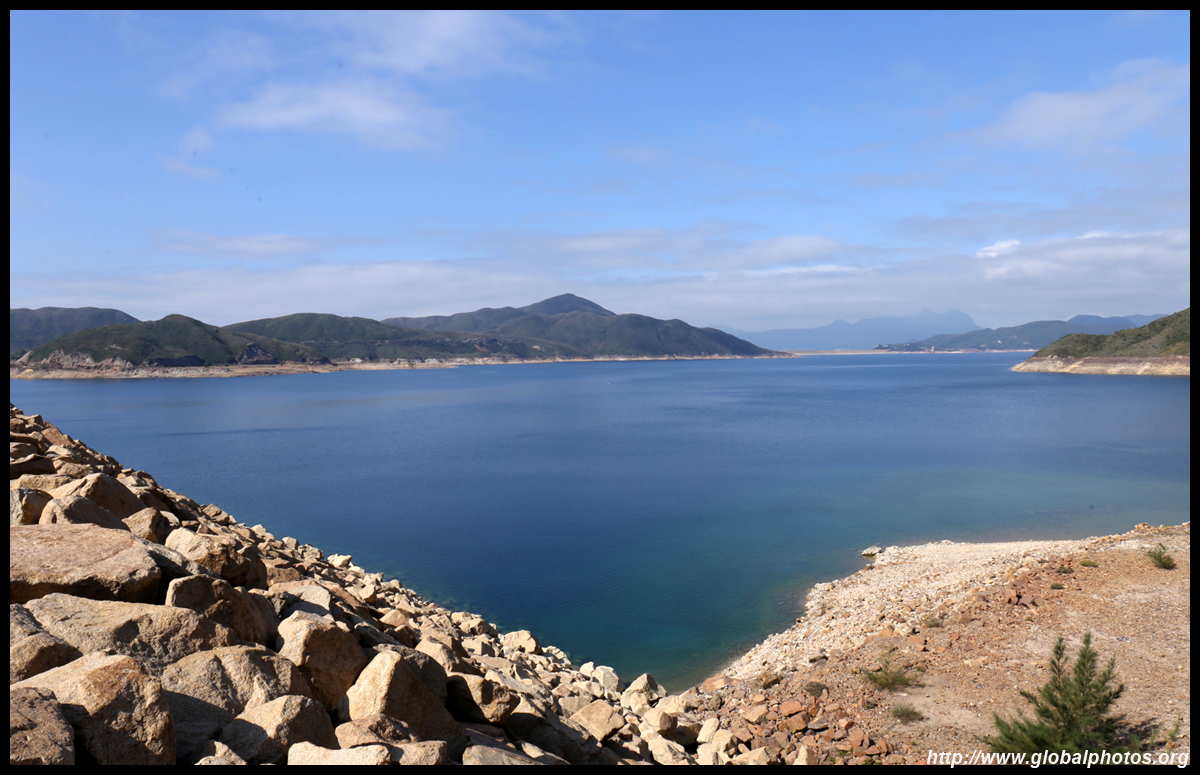
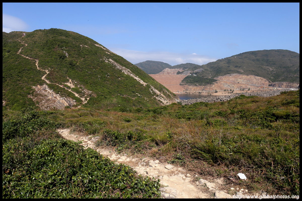
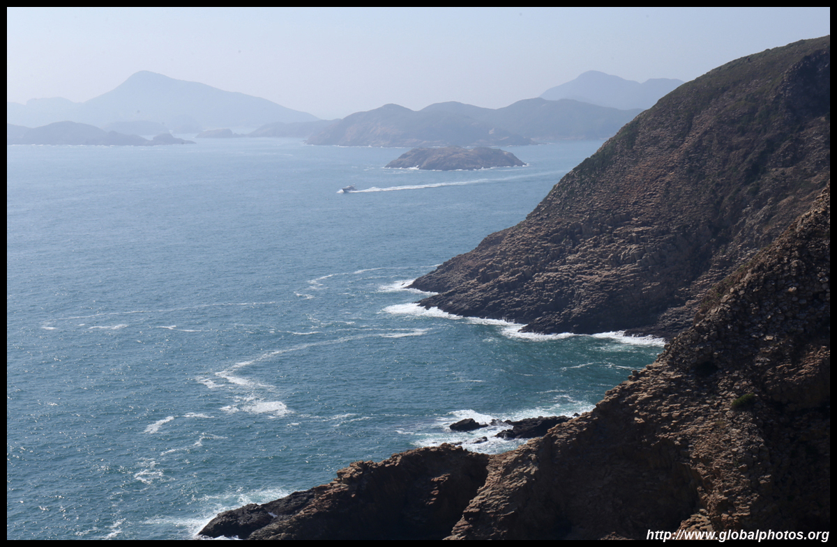
Looking back, the reservoir is not far away and the hike to this point doesn't take long at all.
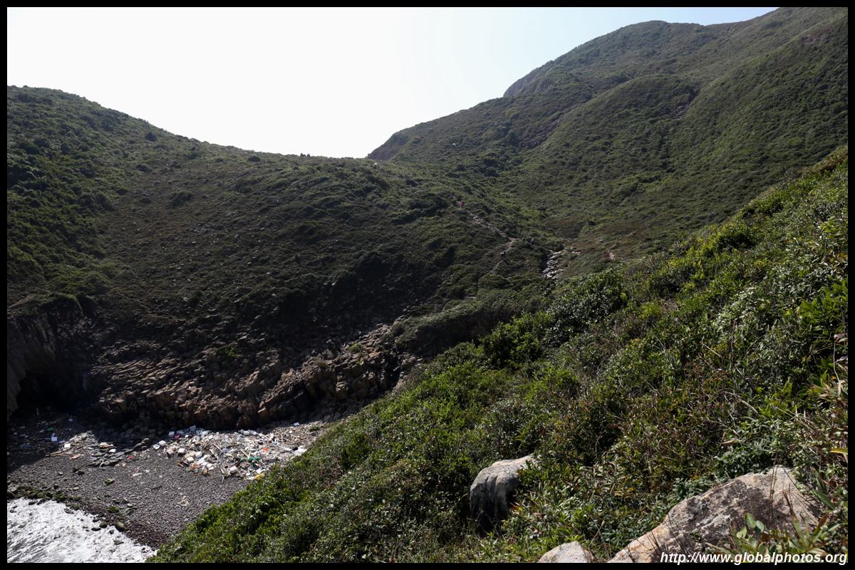
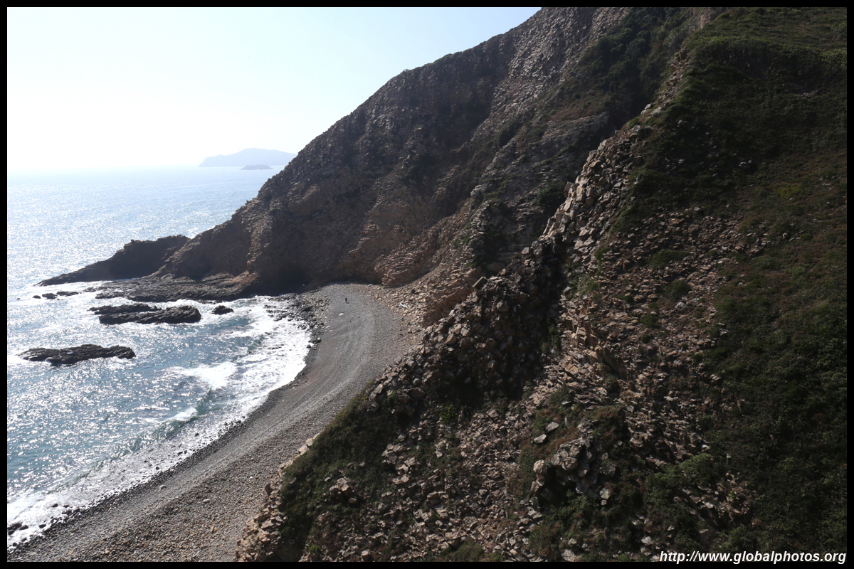
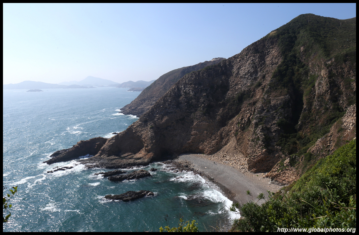
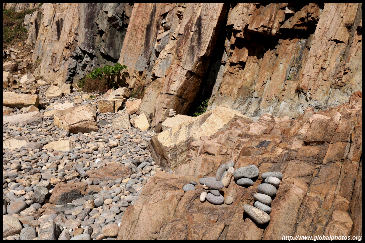
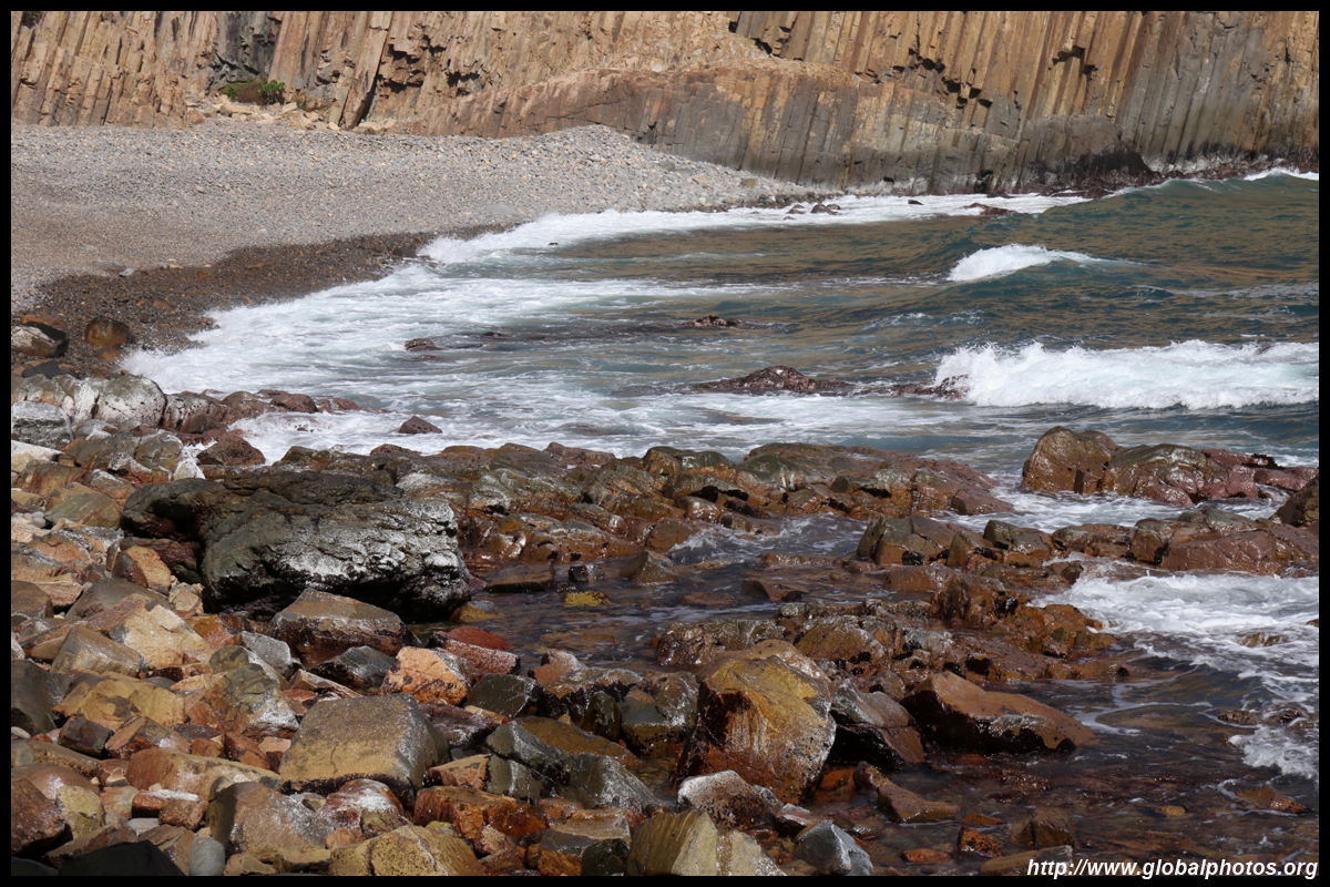
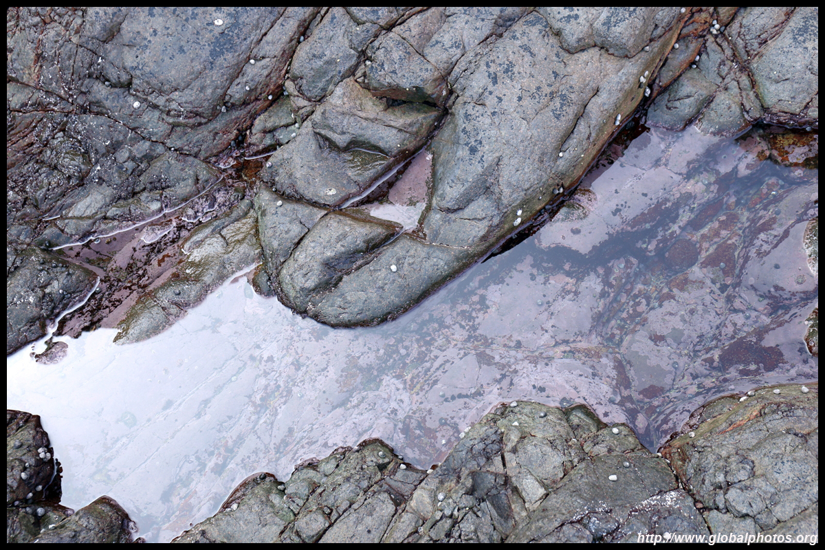
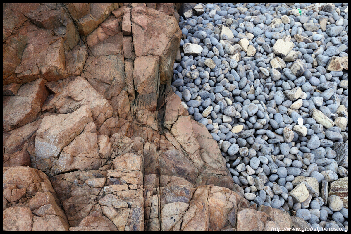
Heading back downhill a little, you will see a slippery path down to Kim Chu Wan, which is marked by a danger sign. There is a rope to manage the slide down, but only the start is difficult. Most of the descent is manageable but I suggest to wear gloves.
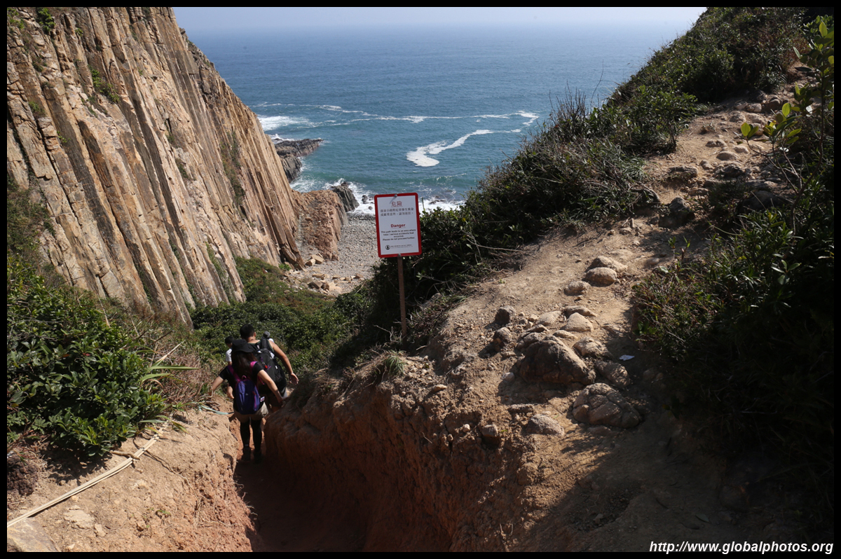
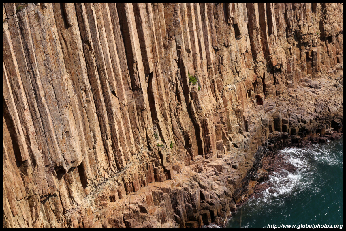
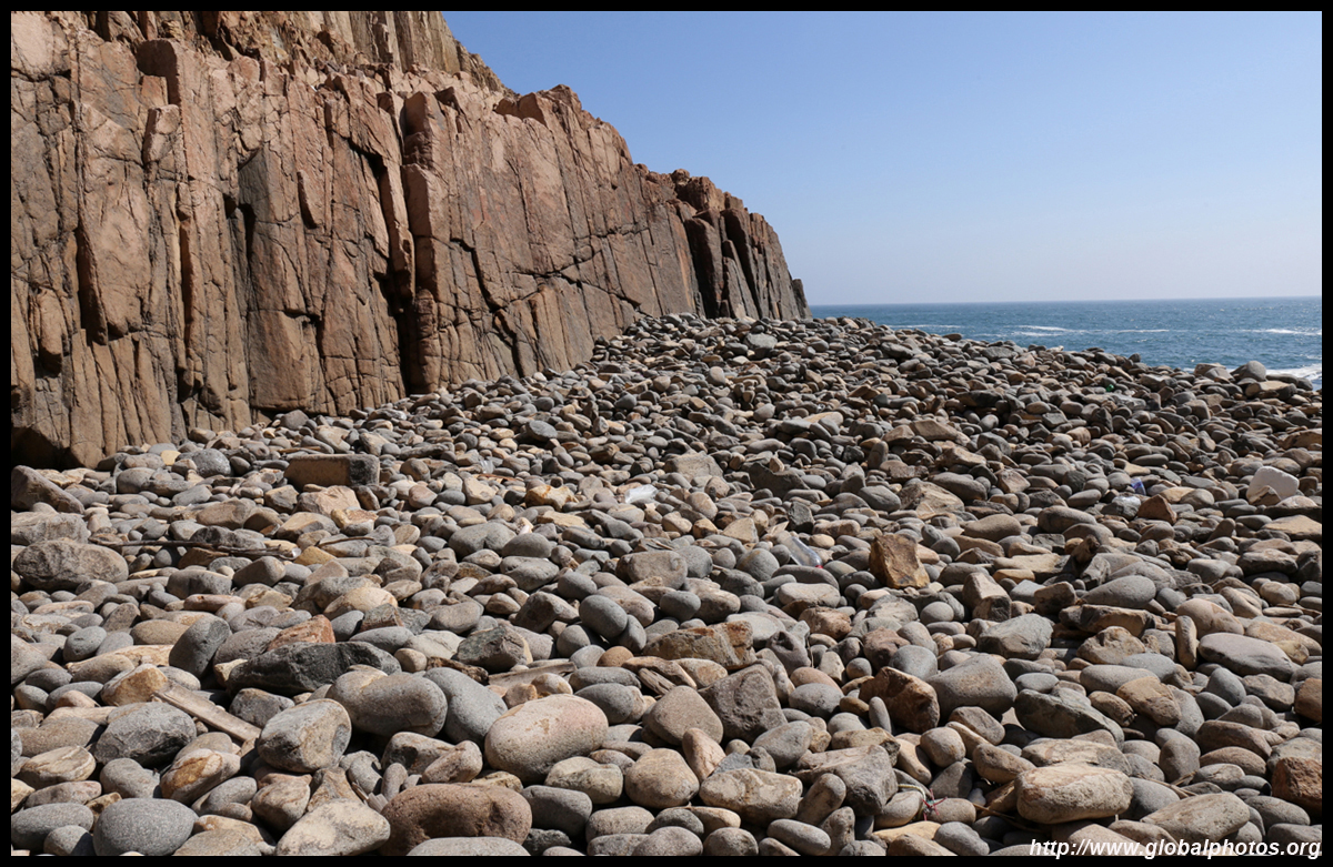
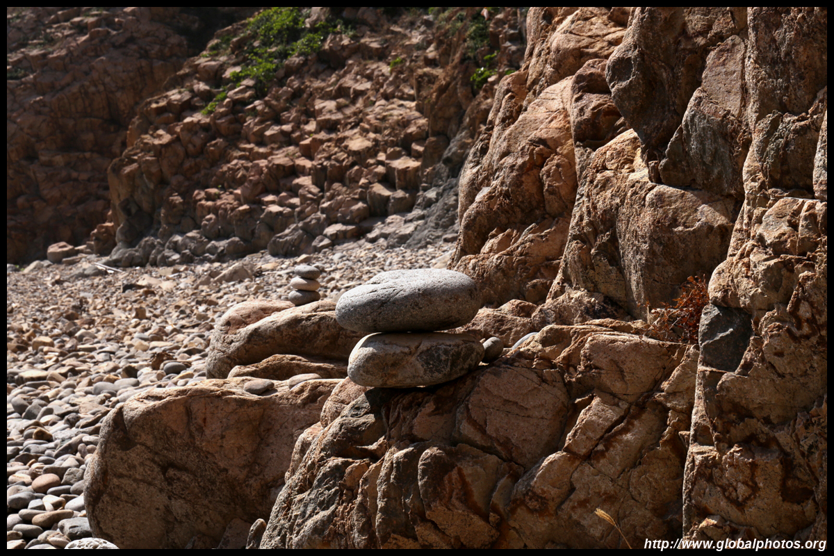
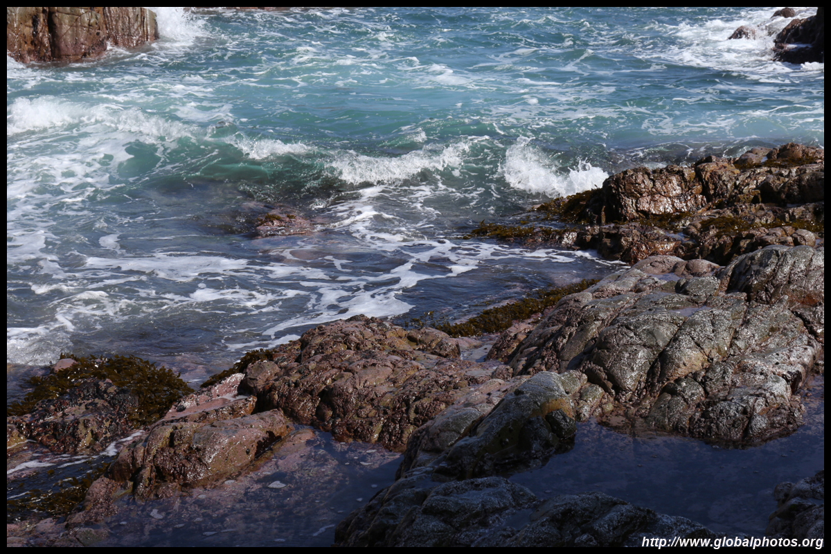
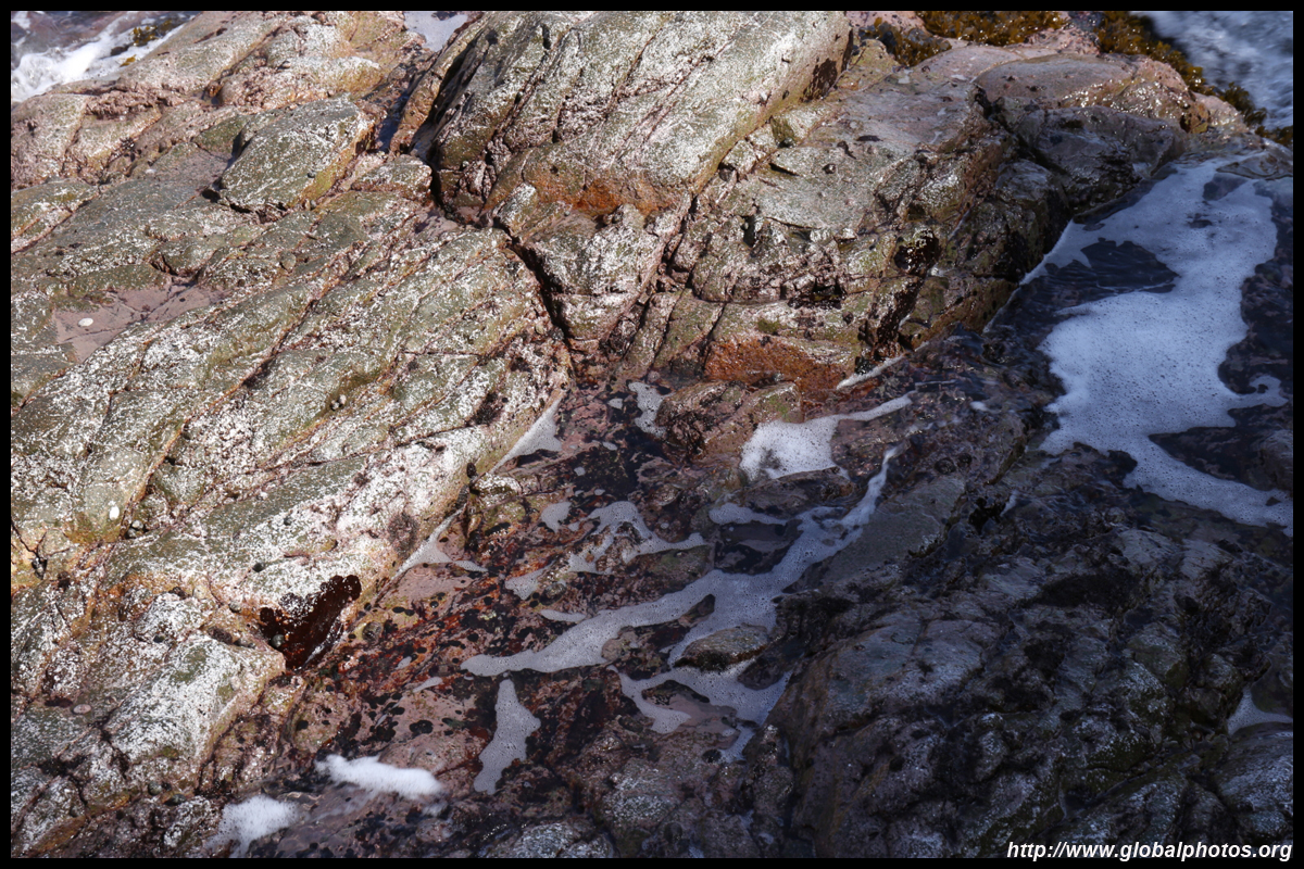
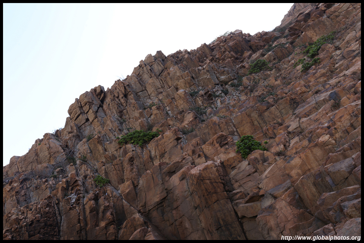
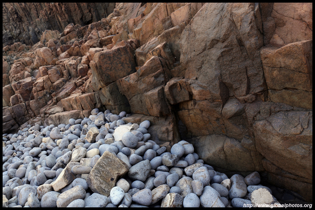
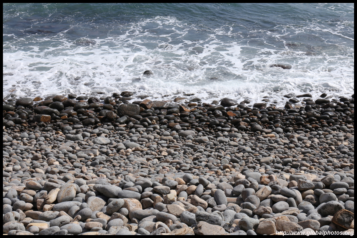
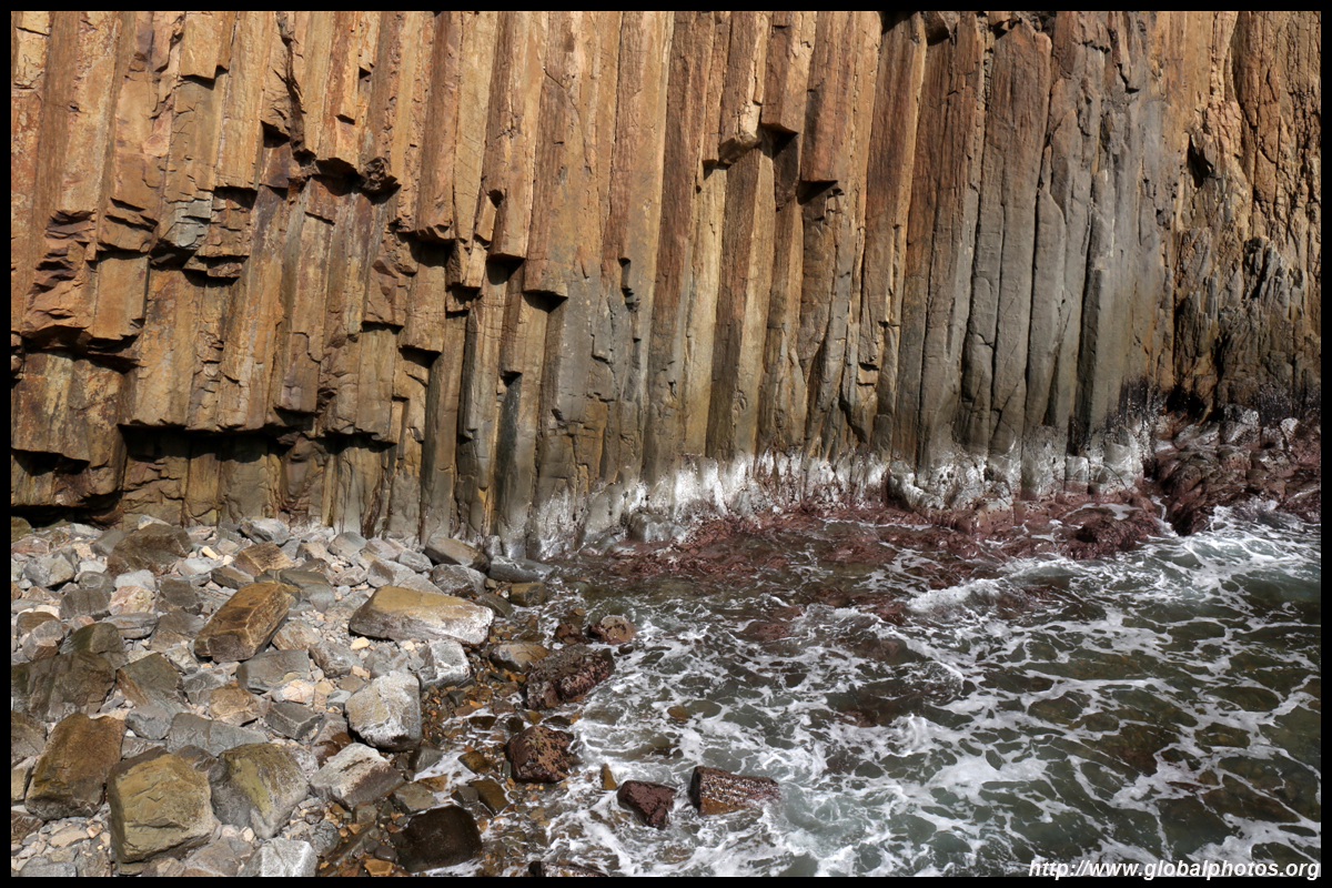
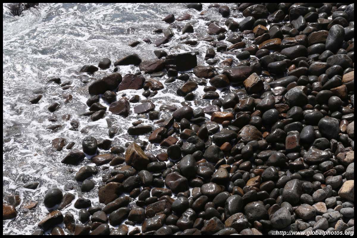
You can get up close and personal with the rock columns at the beach.
I walked to the other side of the beach where it was more shady for a well-earned snack break. This hike is best done in the morning as it faces east and the sun shines in the right direction. By late afternoon, the sun would have descended behind the hills.

Satisfied, return back to the dam the same way you came. Another benefit of doing this hike early is that there should be taxis waiting at the dam by lunch time as hikers continue to stream in. Otherwise, you will need to try your luck with the minibus that starts service at 3pm on Sundays only.
