|
|
|
| Hong Kong has many hiking trails through its mountains and along beautiful coastlines. Get some inspiration here as to where your next scenic hike will be!

|
Newest Features
|
 |
Sir Cecil's Ride
|
In the hills above North Point, Quarry Bay, and Tai Hang is Sir Cecil's Ride, a hiking trail stretching over 8km long that offers panoramic views of the harbour. It's a fairly easy trail and well worth the effort to climb up. 
|
 |
Lung Ha Wan Country Trail
|
Lung Ha Wan Country Trail is a relatively easy hike with marvellous views of Sai Kung. At about 6km long, this is a good half day hike that is not too difficult but more than compensated by the lovely views.
|
 |
Lam Hang Shan
|
I normally recommend heading to Lau Fau Shan and Pak Nai for a sunset view of Deep Bay and China on the other side. But Lam Hang Shan is a community hangout point with a short climb from Tin Shui Wai to 2 hills offering views.
|
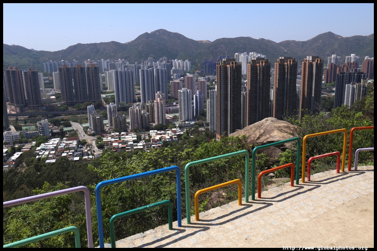 |
Tuen Mun Trail
|
This relatively easy hike has lovely views of Tuen Mun as well as coloured railings that make this short trail even more interesting.
|
 |
Lantau Trail - Section 9
|
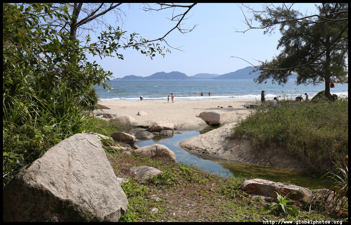
Lantau Trail's Section 9 is an easy but scenic hike from Shek Pik Reservoir to the village of Shui Hau, passing through a rock carving, forests, ocean views, and even a beach. At about 6.5km long, it's an easy few hours and you can combine it with other attractions on Lantau's south coast.
|
 |
Quarry Bay to Tai Tam
|
An easy paved journey up the hills behind Quarry Bay and down towards Tai Tam Reservoir, this family-friendly trail takes a few hours and offers good exercise from the heart of the city. Tai Tam's reservoirs were built from 1883 to 1917, providing freshwater for a growing city and its industries.
|
|
Ma Tseuk Leng
|
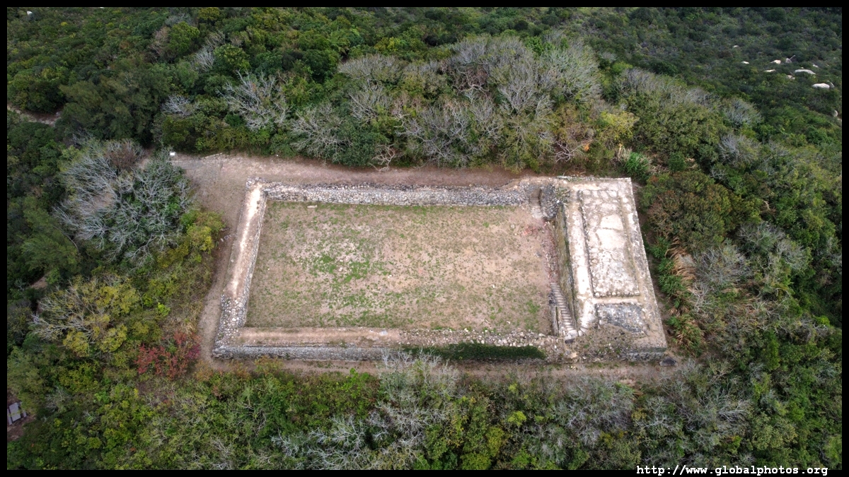
This hike along the tall hills near the China border offer stunning views of Starling Inlet and historic war-time military fortifications. Being remote, long, and a bit difficult, it is off-the-beaten track and hence quieter than other scenic hikes.
|
 |
Old Stanley Road
|
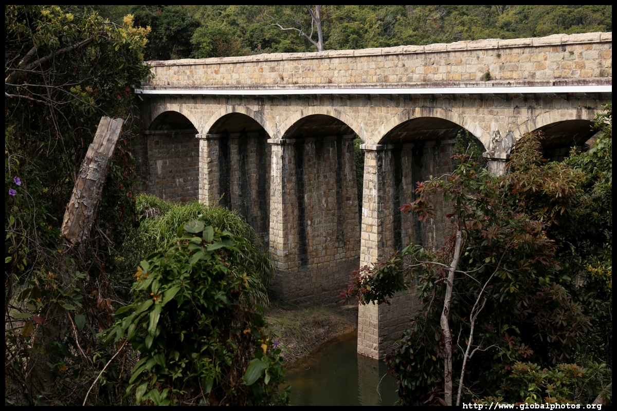
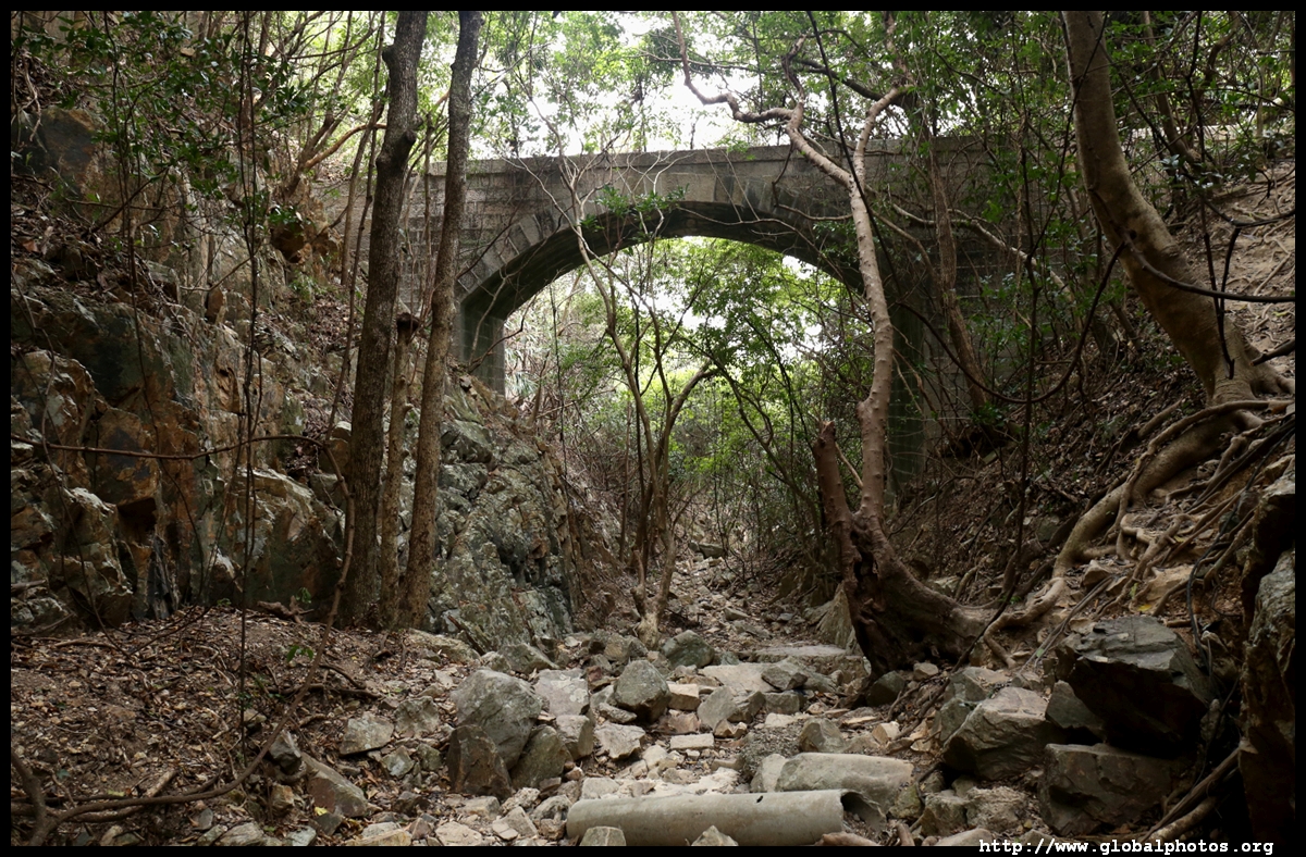
The Old Stanley Road was only recently rediscovered after being forgotten for over a century. An 1845 map had already indicated a road from Stanley to Repulse Bay, and by 1881, the road even reached all the way to Central. Built to accommodate both people and horse carts, it was abandoned after more modern roads reached the area, and nature has since re-conquered it.
|
|
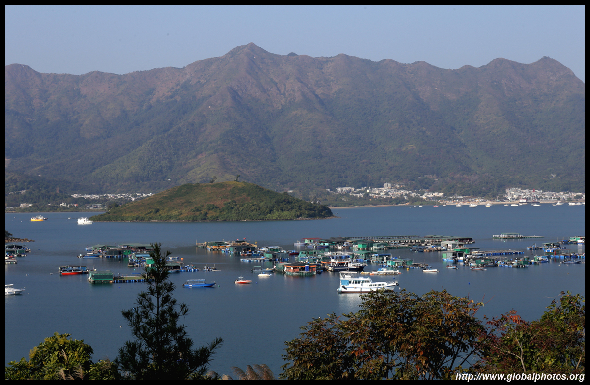
Shui Chuen O - Shatin Pass & Wilson Trail Stage 5
|
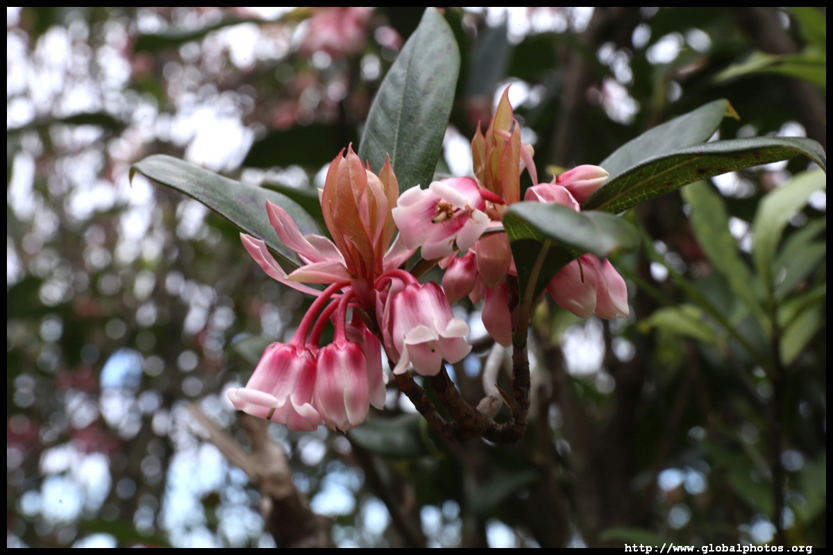
January and February are blooming months for the Chinese New Year flower, appropriately named for its timing. The reverse-hanging pink flowers come in clusters so the tree becomes noticeably bright.
|
 |
Lantau Trail - Fan Lau
|
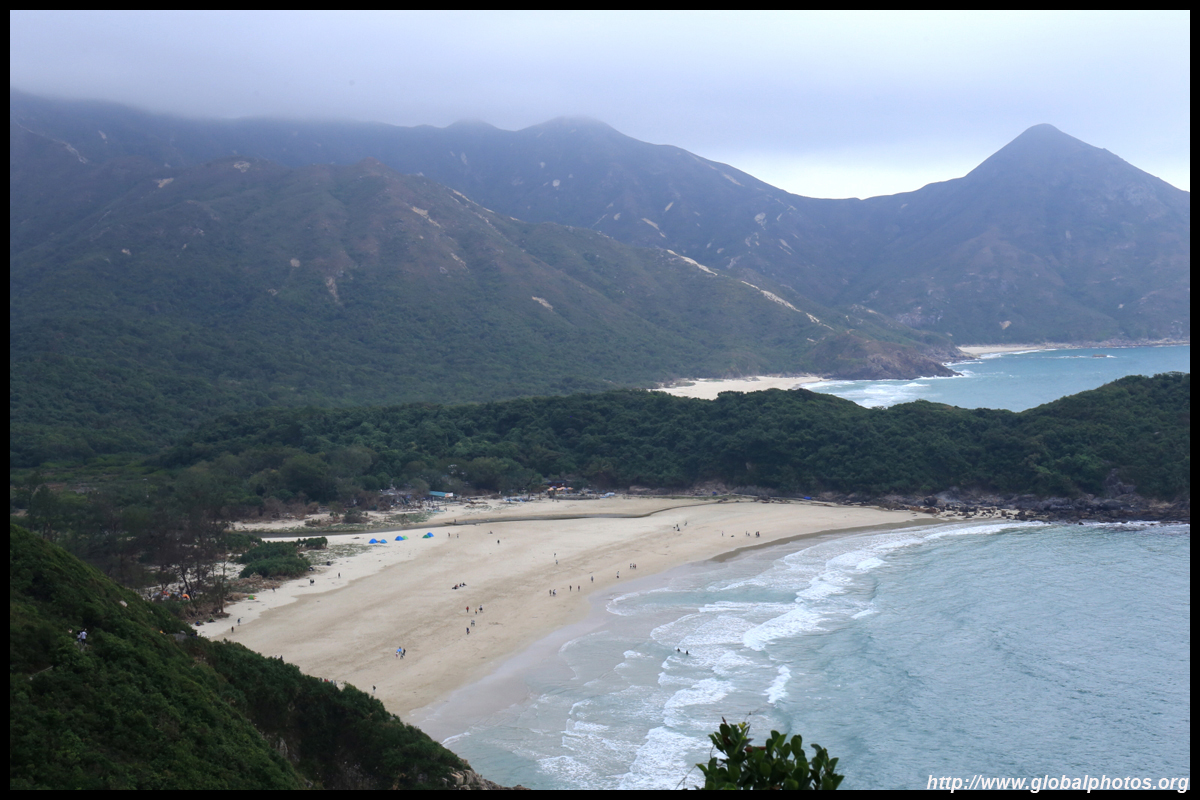
The southwestern edge of Lantau Island is far from civilization and picturesque. The relatively easy hike is long, so it would test your endurance rather than your climbing abilities. The whole trip is almost 20km long and would take the bulk part of the day.
|
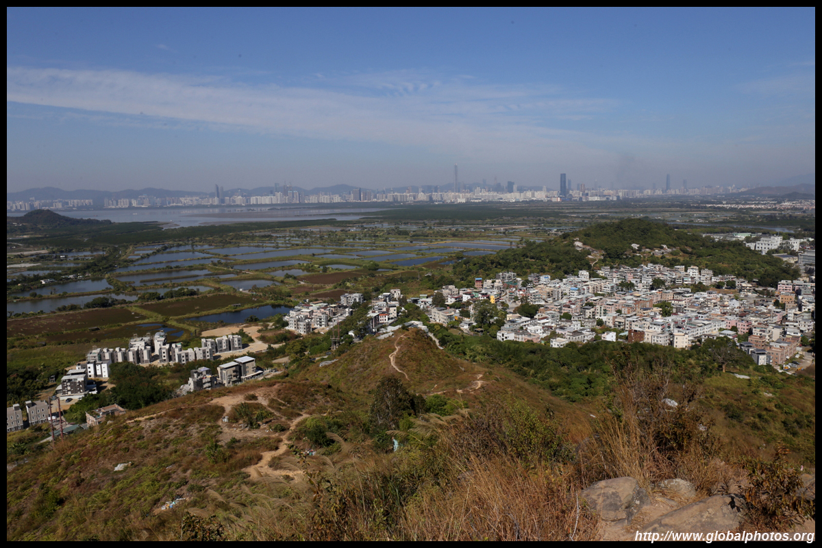
New Territories West
|
|
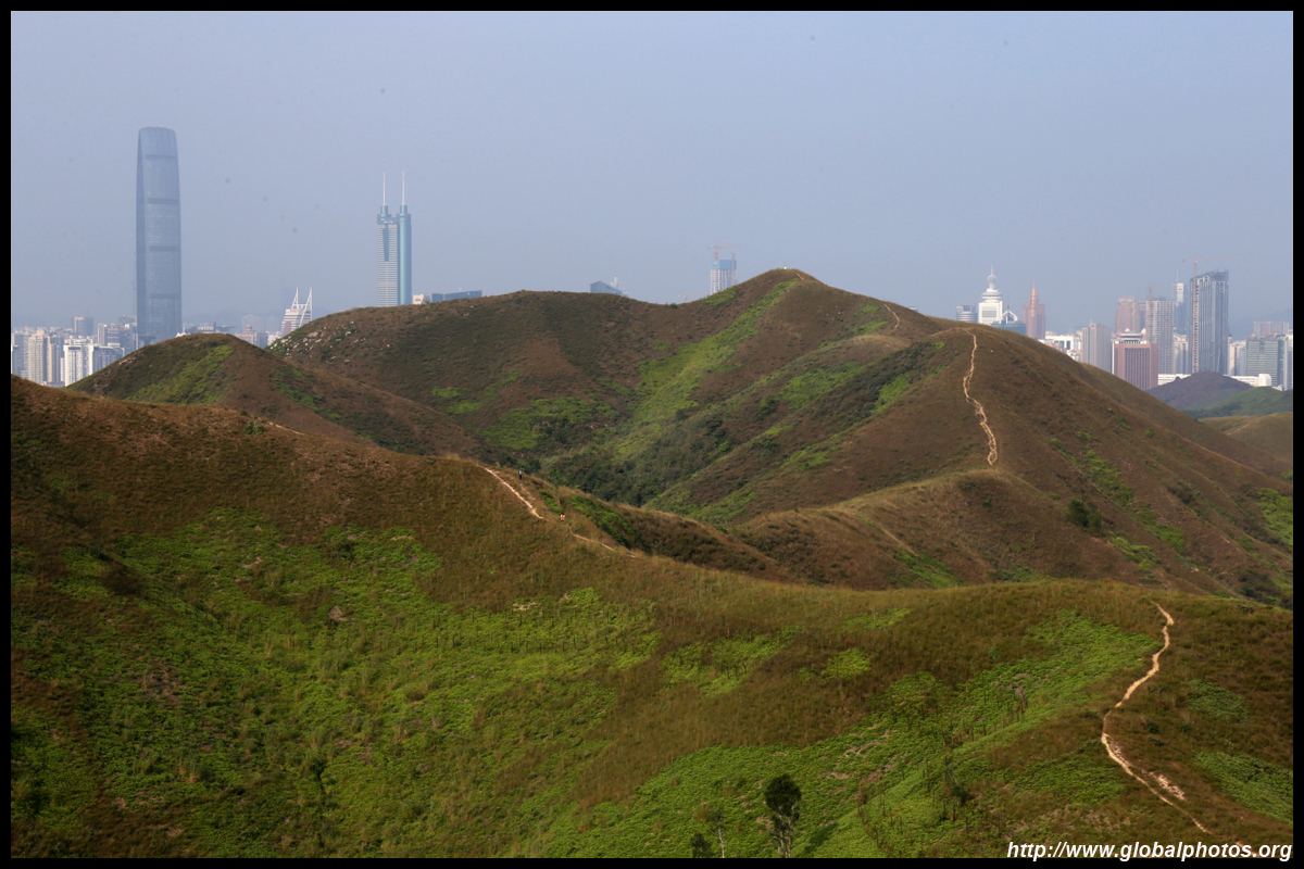
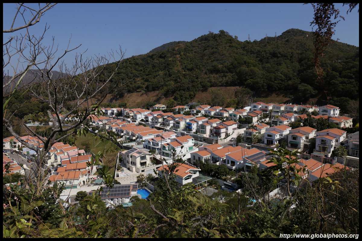
Castle Peak
|
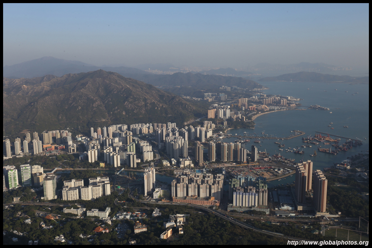
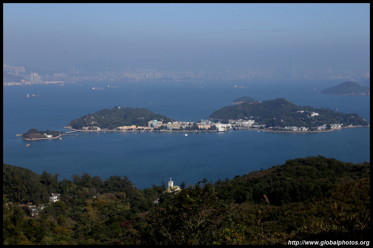
Castle Peak is a lovely place to see 3 skylines on a clear day - Hong Kong, Shenzhen, and Macau. Yes, you read right. But getting there is a challenge as you will go from sea level to over 584m even though the horizontal distance is only about 2.2km. At my slow pace, I was able to reach the top in 70 minutes.
|
|
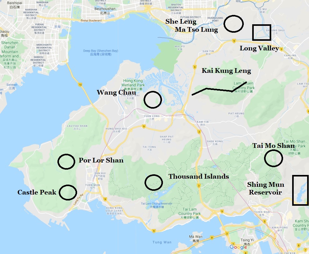
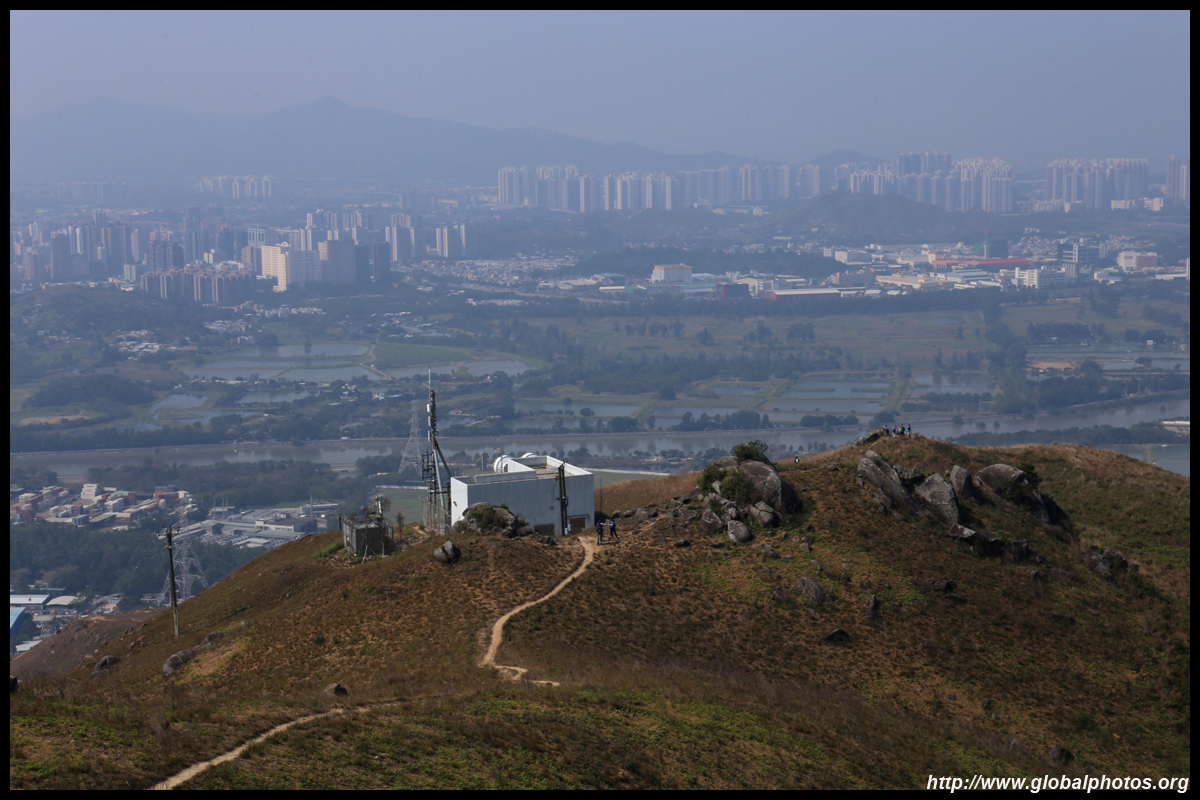
Hiking in Yuen Long
|
Yuen Long has a number of hills with scenic hiking trails. Kai Kung Leng, Wang Chau, and Cheung Ngau Shan are 3 good and relatively straight forward journeys with lovely views.
|
|
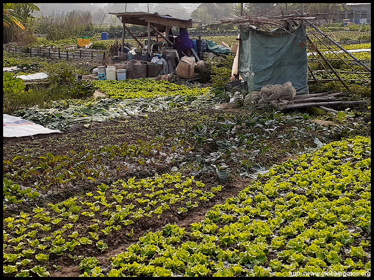
Long Valley
|
The Long Valley wetlands are popular with migratory birds and with agriculture's revival, birds are returning in larger numbers. Roam around the fields and farms freely and ask the farmers to buy their fresh produce, plucked straight from the ground. You can combine this with Ma Tso Lung for a full day outing.
|
|
Lower Shing Mun Reservoir
|
The Lower Shing Mun Reservoir opened in 1965 and is often overlooked as hikers tend to loop around the main Shing Mun Reservoir above. While it is less scenic than its upper counterpart, it has enough stairs and steep gradients for a good work-out.
|
|
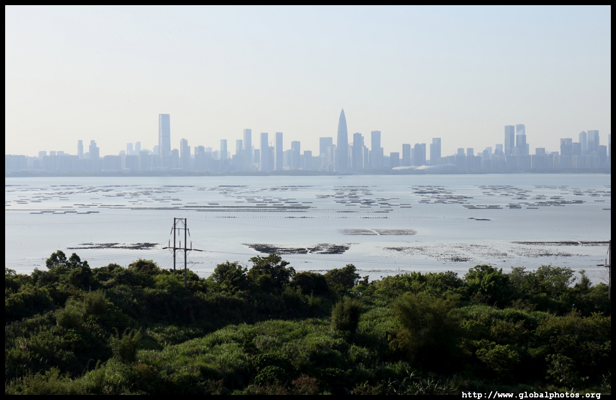
Ma Tso Lung
|
Take the 51B green minibus from Sheung Shui station to Liu Pok and hike uphill to the guardpost that oversees the Shenzhen border. The grasses open up and you will see ponds on the Hong Kong side and Shenzhen's skyscrapers beyond. This location faces north and west hence sunset views are amazing.
|
|
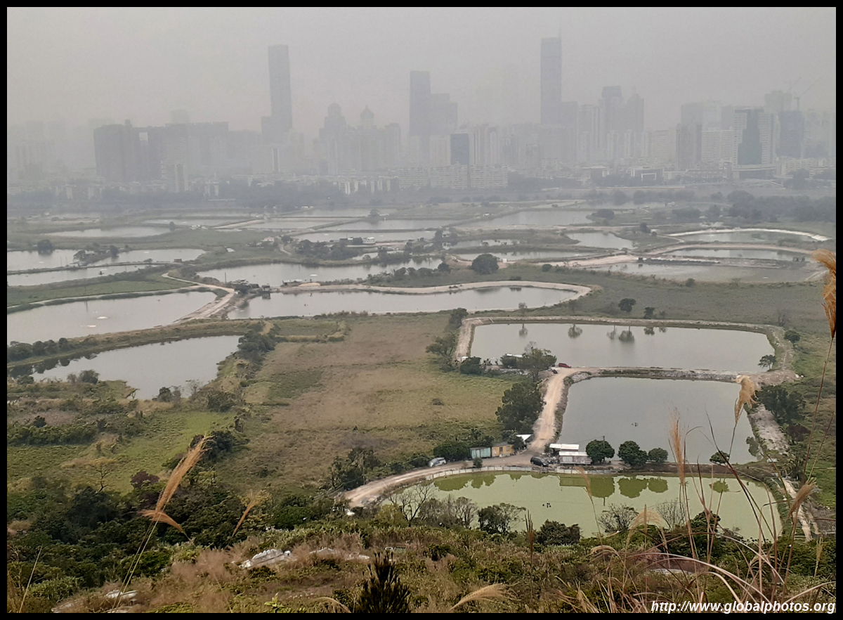
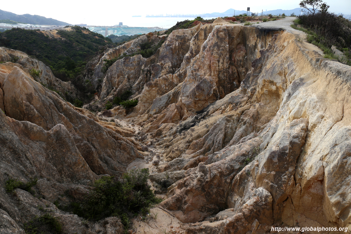
Por Lo Shan
|
Hong Kong's version of the Grand Canyon is technically in a restricted area. A paved path leads up from behind Leung King Estate and ultimately finishes near Pak Nai along Shenzhen Bay. However, weekends in Pak Nai can be incredibly busy with the sunset crowd so prepare to wait a very long time for the minibus out.
|
|
She Leng Hike (Lok Ma Chau)
|
Staying away from the popular trails, head to the northern border areas. This hike is fairly straight forward and while the hills are not very tall, the views are disproportionately good. These parts are dotted with small villages and greenery, and hopefully it stays that way.
As there is minimal cover along the entire route, be sure to wear a hat and lots of sunscreen. This hike takes about 3 hours including many photo stops.
|
|
Shing Mun Reservoir
|
Famous for aggressive monkeys chasing after your plastic bag of goodies, a circular hike around the reservoir is fairly easy. When the water levels are high, trees along the western side are immersed in the water, a special scene that is rare to catch and surreal to photographers.
|
|
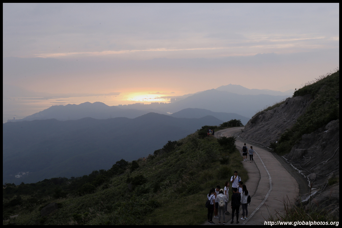
Tai Mo Shan
|
Hong Kong's tallest peak is surprisingly easy to access and the hike is not difficult. Those with wheels can drive up much of the way, and you already get very nice views when you get out of your car. Public transport stops about 2km further downhill, but it is a paved and fairly gentle ascent. That's why this mountain hike can get very crowded on weekends.
Best to make the trip up in the afternoon and wait for the sunset from the top of the city. On a clear day, you can see well past the airport all the way to Macau.
|
|
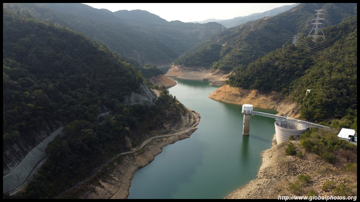
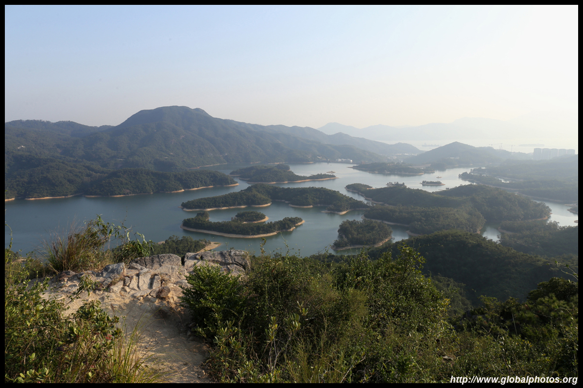
Thousand Islands
Tai Lam Chung Reservoir
|
Well-marked signs lead to a new lookout point towards the reservoir. You can get here from either Tai Tong on the Yuen Long side or from Gold Coast and So Kwun Wat village.
|
|
Wang Chau
|
Threats of redevelopment have lingered over this area for years. Beyond the village, dirt paths lead behind the hills to a vantage point towards the north. Look for an entrance on Long Ping Road just off the West Rail station.
|
New Territories East
|
|
Ap Chau
|
A sole weekend ferry takes you to both Kat O and Ap Chau, 2 islands in Mirs Bay just off Sha Tau Kok. There are nice rock formations, an old bustling fishing village, and abandoned buildngs.
|
|
Cloudy Hill
Parts 1 & 2
|
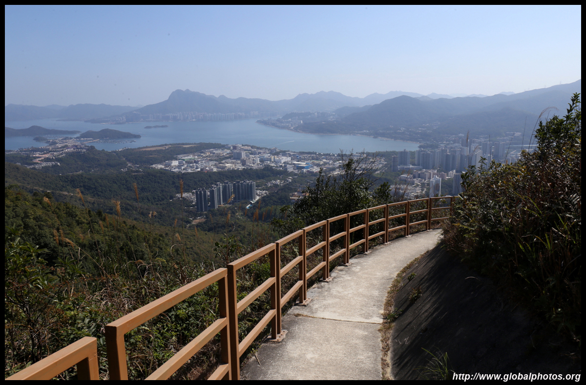
Tai Po is separated from the other northern suburbs by a set of tall hills. A relatively easy and scenic hike is up to Cloudy Hill, which stands at over 440m tall. Part of the Wilson Trail's Stage 8, access is quite easy from Tai Wo station. On one side, you will see Tolo Harbour all the way to Plover Cove Reservoir and Ma On Shan, while Shenzhen's skyline lies in the distance on the other side of the ridge.
|
|
High Junk Peak
|
Take bus 91 to Clearwater Bay and get off at Ng Fai Tin. The staircase is just across the street and enjoy this challenging hike. Getting to the top of High Junk Peak requires some scrambling so gloves are necessary. However, to enjoy views of the city and also that peak from a distance, go up the hill before it instead.
|
|
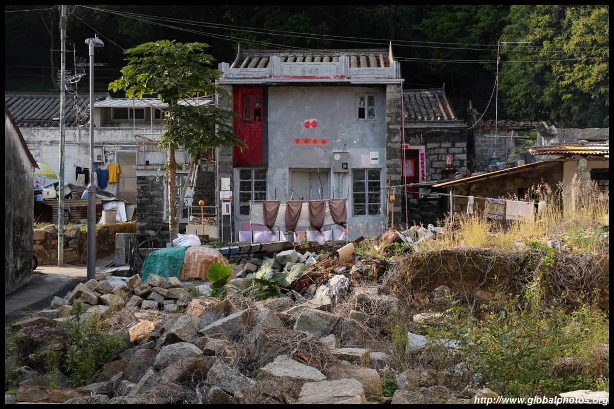
Kat O
|
A sole weekend ferry takes you to both Kat O and Ap Chau, 2 islands in Mirs Bay just off Sha Tau Kok. There are nice rock formations, an old bustling fishing village, and abandoned buildngs.
|
|
Hiking to Lai Chi Wo
|
Rather than taking the ferry to the seaside village of Lai Chi Wo, it is possible to hike there in a few hours from Wu Kau Tang, which itself was an old Hakka village. Lai Chi Wo is being revitalized after the village was abadoned in the 1960s with many residents moving to the UK.
|
|
Luk Keng to Kuk Po Hike
|
The shores of Sha Tau Kok are far from the city and people typically arrive by car. The waterfront walk is quite flat but scenic, and you can spot Shenzhen's Yantian district across the water while the Hong Kong side still remains mostly rural.
|
|
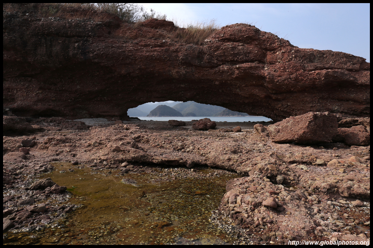
Lung Ha Wan
|
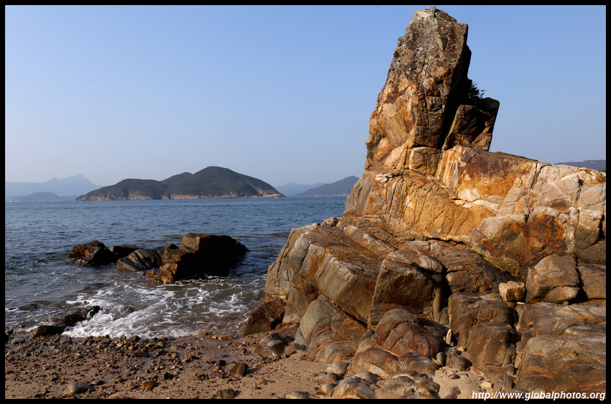
Beneath High Junk Peak is a flatter hike but you are much closer to the sea. Take bus 91 to Clearwater Bay and get off at Tai Au Mun. Then walk about 2km along Lung Ha Wan Road to the coast where you will find a rock carving and a small beach further down. Horse lovers take note; there is an equestrian academy tucked away at the end of the road.
|
|
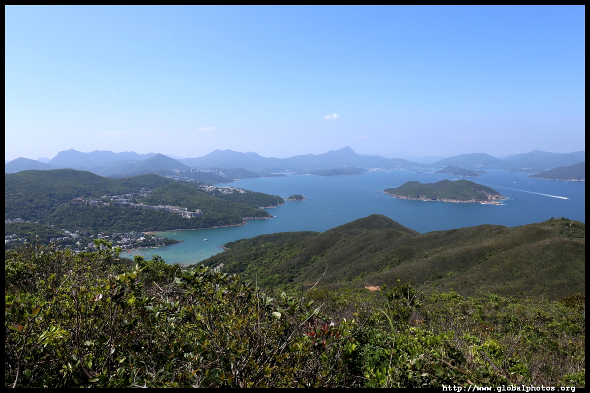
Sai Kung East
|
Take a taxi to the Sai Wan Pavilion deep in Sai Kung. There is no place to park around here. Despite its relative isolation, this stretch of hiking trail through several scenic bays and through the hills is immensely popular and there are even tour groups roaming the paths. Those looking for a quiet way to enjoy nature will be disappointed.
|
|
Sam Mun Tsai
|
Still an authentic fishing village, this is a much quieter alternative than nearby Plover Cove Reservoir. Once past the village, you will have a commanding view of Tolo Harbour and spot Tai Po and Ma On Shan new towns in the distance. The next island, Ma Shi Chau boasts some of the oldest sedimentary rocks in the city.
|
|
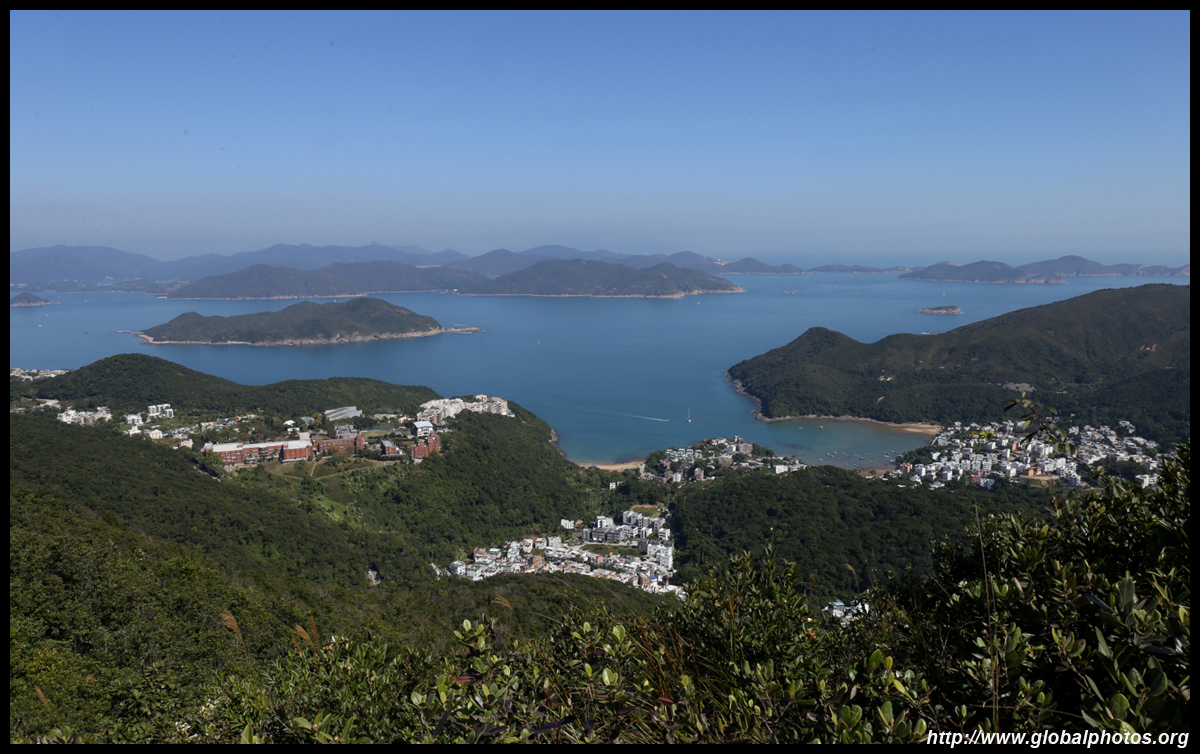
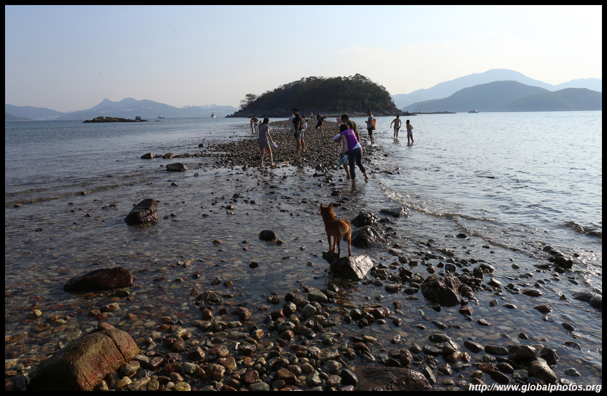
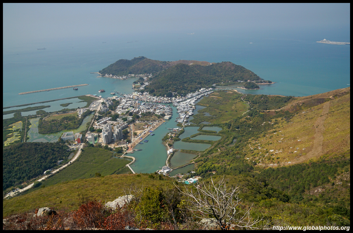
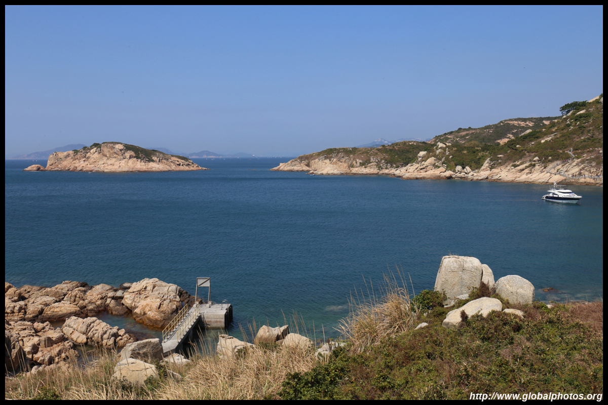
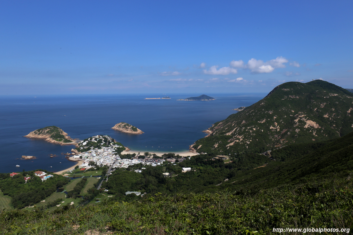
Sharp Island
|
Ferries make a multi-stop journey off Sai Kung and I added Sharp Island to my excursion to Yim Tin Tsai. The natual sand levee is quite interesting, with rocks exposed during low tide, although you should wear waterproof shoes or sandals since you will very likely get wet! If you have time, take the hiking path up the hills to the other side of the island for a quiet beach.
|
|
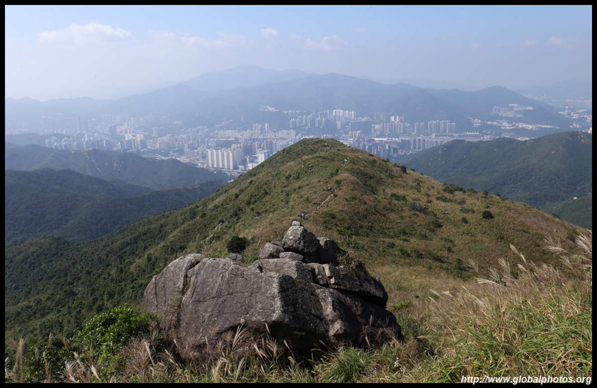
Shatin to Sai Kung via Buffalo Hill
|
Hiking has become a popular weekend activity with the borders shut. Besides the 100 km-long MacLehose Trail, Hong Kong has many other scenic trails worth exploring. This trail is one of several that traverses between Shatin and Sai Kung, offering a moderately-challenging exercise.
This hike takes about half a day including ample time for photo stops. Start from the Shatin side mid-morning and reach the top to take photos behind you in the right lighting. During the afternoon, you will descend to Sai Kung with the sun behind you.
|
|
Tap Mun
|
A popular camping island, get here early to stake a spot, and by night-fall, you can't help but think the city has moved offshore. Located in the east, this is a great place to see the sunrise. You are not totally in nature though; there is a village that can offer supplies.
|
|
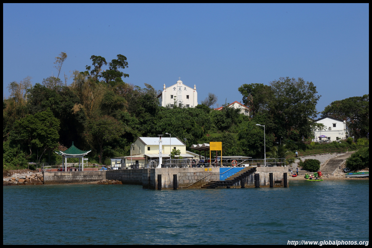
Yim Tin Tsai
|
Catch a ferry from Sai Kung's pier to visit this unusual island of Hakka heritage but Christian believers. The missionnaries came in the late 19th century and even built a large church here. While the last resident left in 1998, the village is now being rediscovered and the salt pans are being revived.
|
Lantau
|
 |
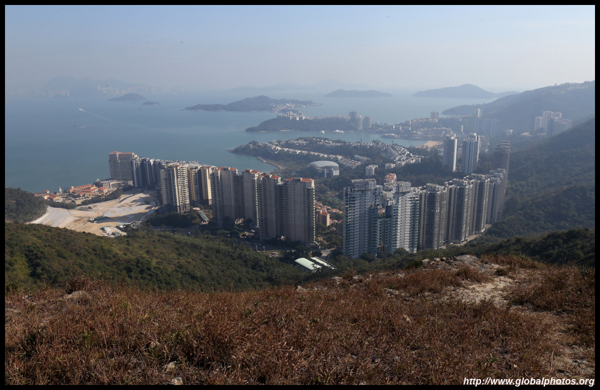
Discovery Bay to Mui Wo Hike
|
This is a fairly easy scenic hike with skyline and sea views that connect 2 vastly different towns. Discovery Bay is a favourite expat haven where cars are not allowed into town, but Mui Wo is a traditional Chinese community that is grittier and feels less upscale.
|
 |
Lantau Peak Hike Part 1
|
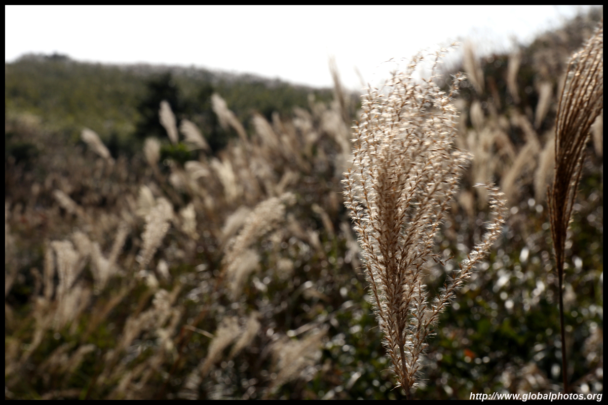
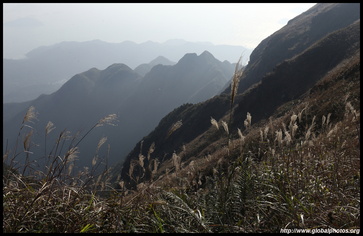
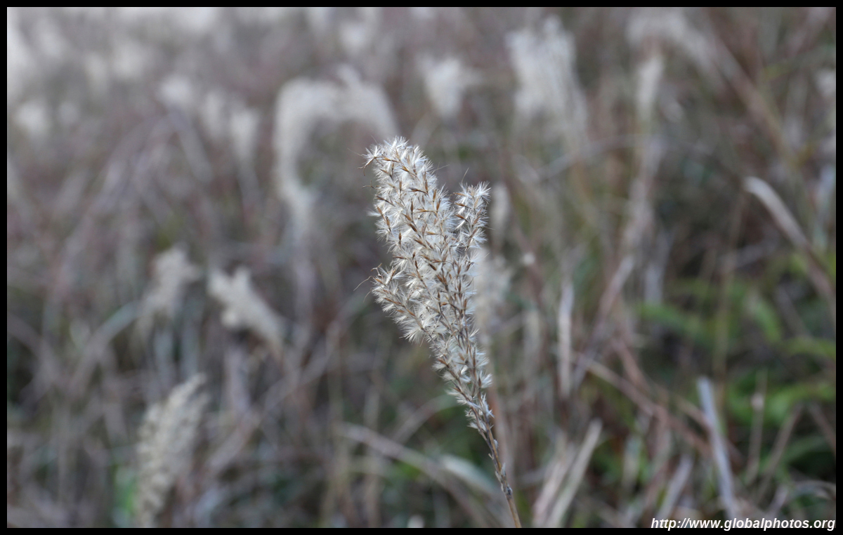
At 934m, Lantau Peak is the 2nd tallest mountain in Hong Kong, making it a good spot to see either sunrise or sunset. This, along with Sunset Peak next door, are very popular hiking destinations. During the late fall, tall yellow grasses dominate the hillsides, offering a spectacular scene for photography enthusiasts.
The entire journey takes 3-4 hours with bus connections to Tung Chung at both ends. It is only a 10 minute ride to the eastern end of the trail and 40 minutes from the western end.
|
 |
Lantau Peak Hike Part 2
|
|
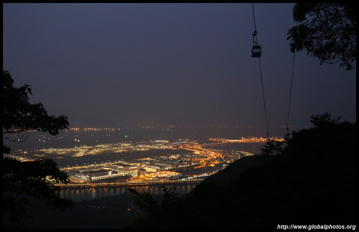
Ngong Ping 360 Rescue Trail
|
For the more ambitious hiker who wants an adventure beneath the Ngong Ping 360 Cable Car, there is a rescue trail built beneath it to service the system. For advanced hikers, start from the Tung Chung end, which includes a very long climb of some 300m up to cable tower 3. Then the trail is relatively flat although there are still some steps here and there, and enjoy views of the airport along the way.
|

|
Tung Chung to Tai O
|
The hike from Tung Chung to Tai O is relatively flat but long at 14.5km. However, you will have a wonderful view of the wetlands next to the residential suburbs, the megabridge to Macau and Zhuhai, as well as the airport along the way.
|
|
Sunny Bay to Discovery Bay
|
Lantau offers many types of trails, and a less-frequented one is through a few hills from Sunny Bay to Discovery Bay, taking a half day with plenty of photo-taking stops and a lot of leg pain after.
|
|
Sunset Peak
|
Popular around year-end for its golden grasses, this is a fairly tough hike with many, many steps even though the bus stop at Pak Kung Au is already a distance uphill.
|
|
Tai O Sze Shan and Cheung Shan
|
Tai O is located at the western edge of Lantau and its stilt houses attract scores on weekends and holidays. While the adventurous can hike over 14km along the coast to reach here from Tung Chung, few know that the mountains behind the town can also be hiked, and the tallest mountain rises past 400m.
|
Outlying Islands
|
|
Lamma Island
(Yung Shu Wan - Sok Kwu Wan)
|
This busy hiking path is full of tourists with many shops along the way to arouse your curiosity. The scenery is nice especially the long slope down to Sok Kwu Wan, but it is too crowded nowadays.
|
|
Lamma Island
(Sok Kwu Wan - Ling Kok Shan)
|
Past the ferries at Sok Kwu Wan, the tourists don't know about this deserted path leads to more scenic parts of the island with nobody around. Hike up Ling Kok Shan for a panoramic view of the sea, Hong Kong Island, and Sok Kwu Wan.
|
|
Po Toi Island
|
Limited weekend ferries as well as sparse weekday service keeps this island, the southernmost in Hong Kong, relatively quiet.
|
Kowloon
|
 |
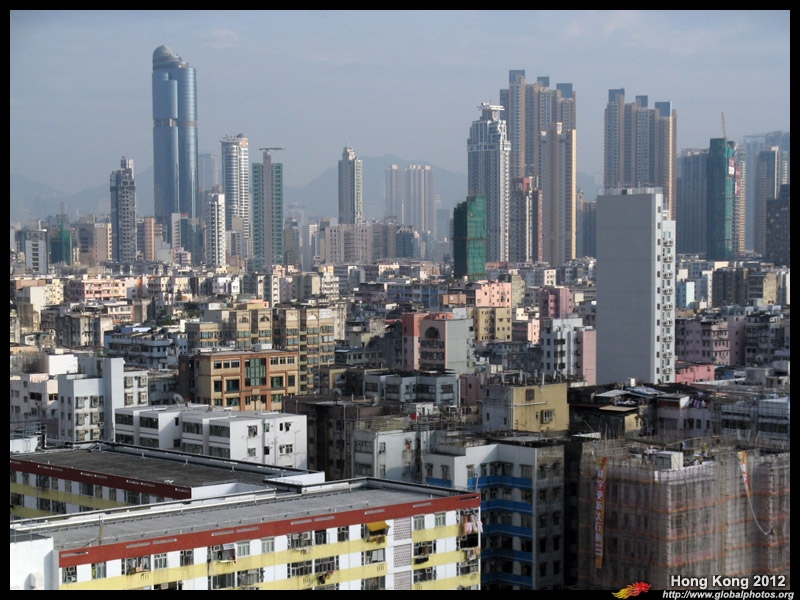
Beacon Hill
|
Beacon Hill is an easy hike with very nice views of Kowloon and a little bit of Shatin. The journey is mostly paved with a section of dirt trail that is not very steep and manageable by novice hikers. However, keep an eye on monkeys and keep bags away from their hearing and sight range. They are very accustomed to humans in their habitat and will jump on you if a plastic bag is around. They assume there is a lot of delicious food inside every bag.
|
|
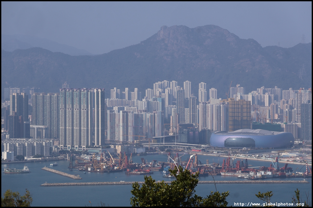
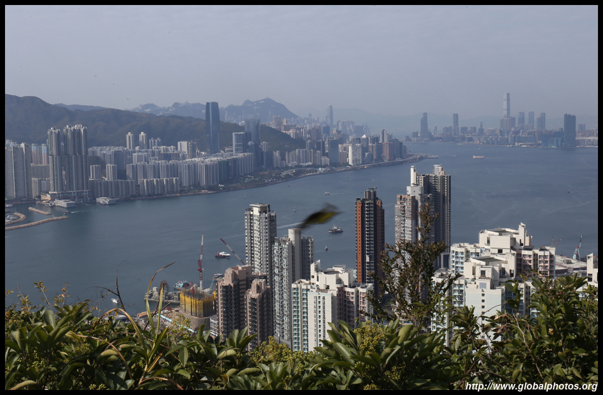
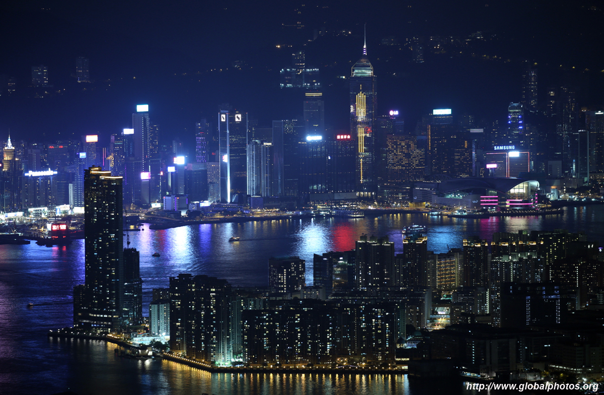
Devil's Peak

|
Located at the eastern end of the harbour, this is a good spot for sunset with the skyline right in front of you. Well known as it is part of the Wilson Trail, prepare for crowds and professional photographers. For the best lighting to capture the harbour, get up here early before noon or at sunset. Don't forget to visit the historic battery as well.
|
|
Fei Ngo Shan
|
Fei Ngo Shan offers unobstructured views of Kowloon and across the harbour. To avoid a long uphill climb, it is possible to drive up to the best viewing spots, although it does get busy as there are no proper parking lots at those heights. Head there well before sunset and enjoy the views on both sides of the divide. Sai Kung's lowrise serenity and its many islands continues to be the city's backyard.
|
|
Garden Hill
|
Beside Mei Ho House, a youth hostel and also museum on Hong Kong's first public housing estate, a staircase leads up to a viewpoint of Sham Shui Po. Garden Hill has become increasingly popular these days thanks to its accessibility and nice views of a rapidly-changing area.
|
|
Ping Shan and Shum Wan Shan
|
Above Kowloon East's public housing estates is a short but scenic trail that rises on 2 hills surrounding Jordan Valley Park. It is relatively easy to access by public transport and the trail varies in difficulty from boring paved stairs to rugged steep rises on dirt paths with ropes to help.
|
|
Tseung Kwan O - Yau Tong Hike
|
Many hiking trails snake around the urban areas. In the old days, people used to hike across the hills between Tseung Kwan O and Kowloon. Today, these trails are once again open to explorers and exercisers alike. This tour begins in Tiu Keng Leng, and terminates in Yau Tong, passing several summits along the way.
|

|
Tsing Yi Nature Trail
|
A short walk on paved paths from Cheung Wang Estate, the forests open up for a view of Tsing Ma Bridge as well as the rest of Tsing Yi.
|
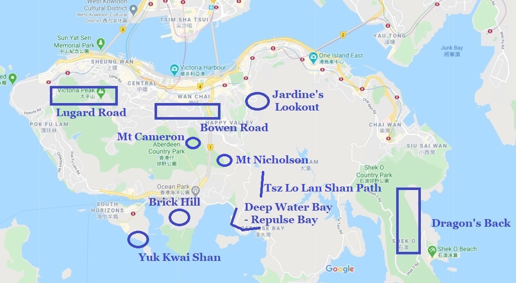
Hong Kong Island
|
Bowen Road
|
This popular jogging path along the hillsides offers many spots to view the Wan Chai area and the harbour.
|
|
|
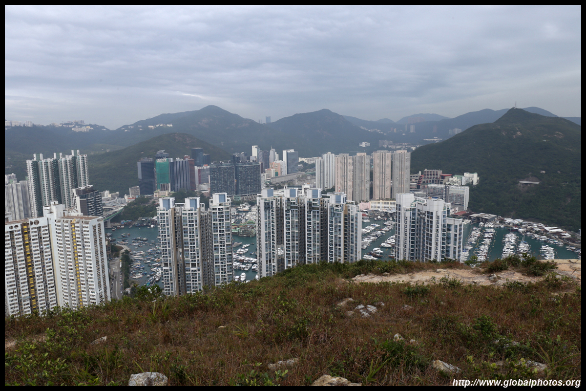
Brick Hill
For a good view of Aberdeen, the yacht-filled typhoon shelter, and sunset, Brick Hill is relatively easy to access. From Wong Chuk Hang MTR station, head along Nam Long Shan Road and a long staircase will emerge past the Bradbury Hostel.
|
|
|
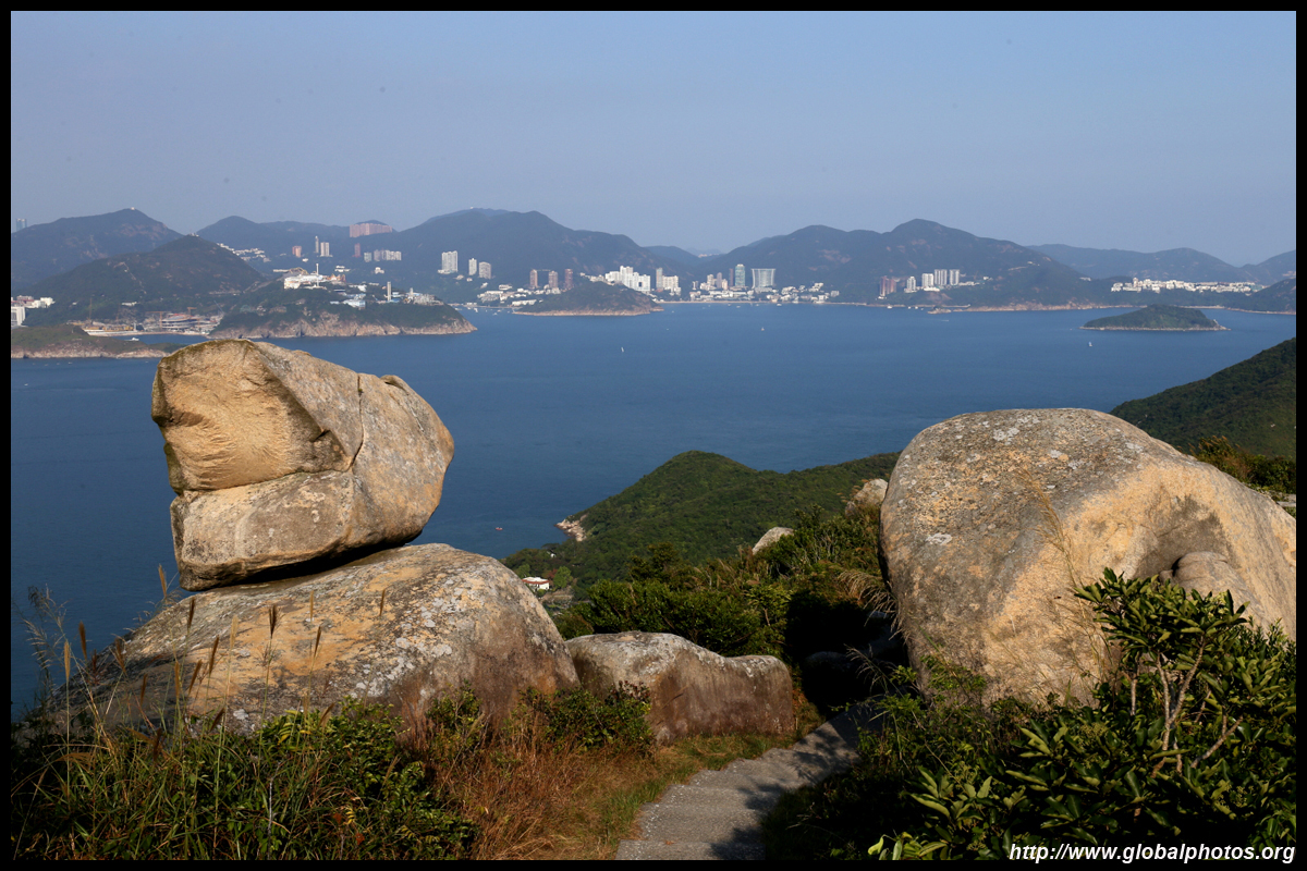
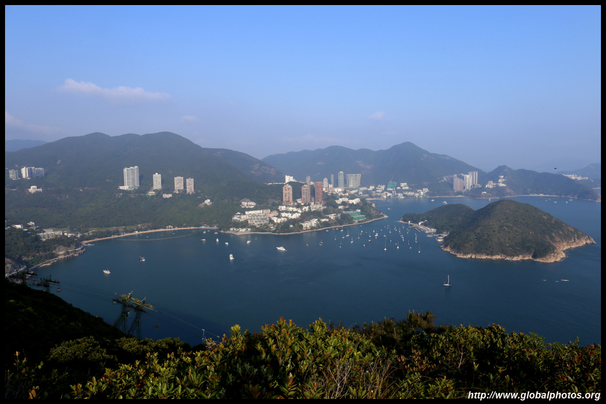
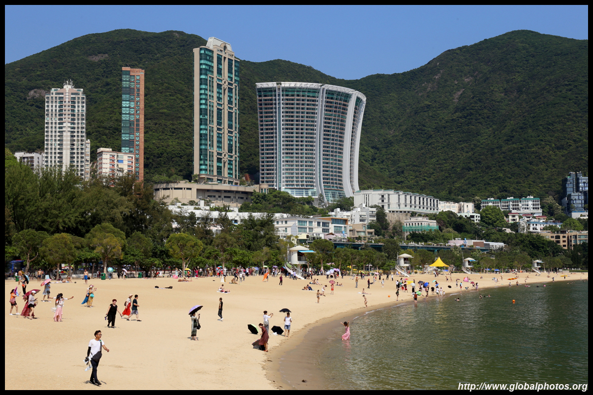
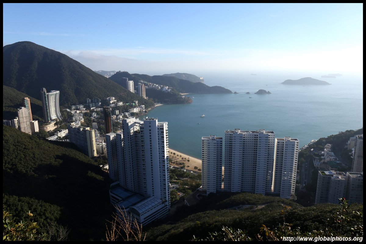
Deep Water Bay - Repulse Bay
|
The easy and flat walk from Deep Water Bay to Repulse Bay offers plenty of waterfront views. From Central, take bus 6, which serves both bays and continues to Stanley.
|
|
Dragon's Back & Shek O
|
Take bus 9 from Shau Kei Wan MTR station and get off at To Tei Wan. You are already uphill at this point so it doens't take too long to reach the top of the ridge. For the best lighting, hike this trail during the afternoon.
|
|
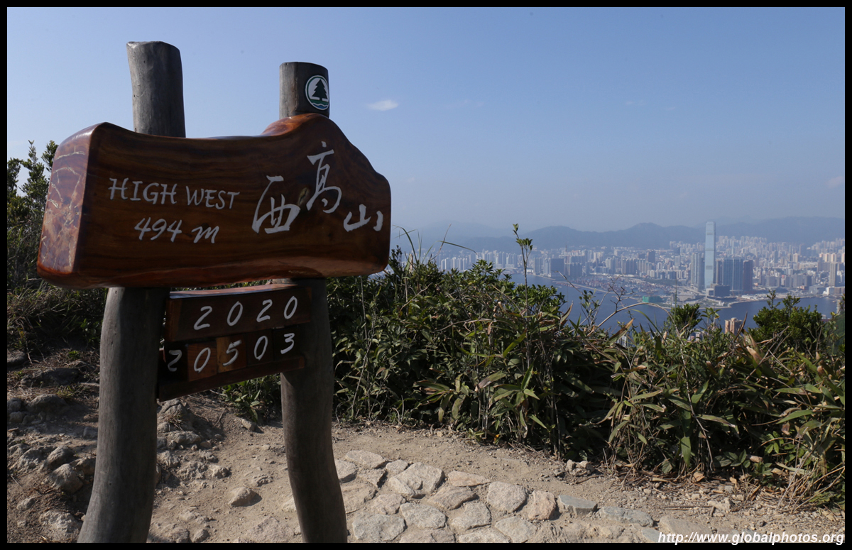
High West
|
While hikers and tourists marvel at the views from Lugard Road, there is a hiking path up to an even higher viewpoint that opens up towards the west and sunset.
|
|
Jardine's Lookout
|
A well-trodden path from Hong Kong Parkview leads to the perfect spot to watch the sunset or fireworks set against the skyline.
|
 |
Mount Nicholson and Mount Cameron Hike
|
This hike covering 2 mountains behind Happy Valley is a bit off-the-beaten-track and is not suitable for beginners. You get to see interesting rock formations such as the "face mask rock" that has recently become an Instagram destination and a skyline view from a more unique angle.
|
 |
Tze Lo Lan Shan Path
|
While hikers seeking an adventure would ascend to the top of Violet Hill on the Wilson Trail, followed by the challenging Twin Peaks towards Stanley, there is a scenic but much easier alternative called the Tze Lo Lan Shan Path that skirts around the hill instead.
|
|
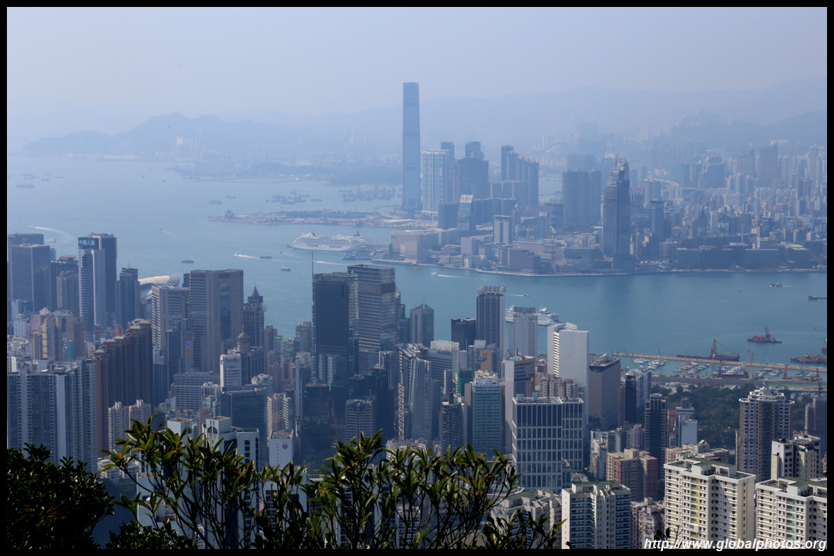
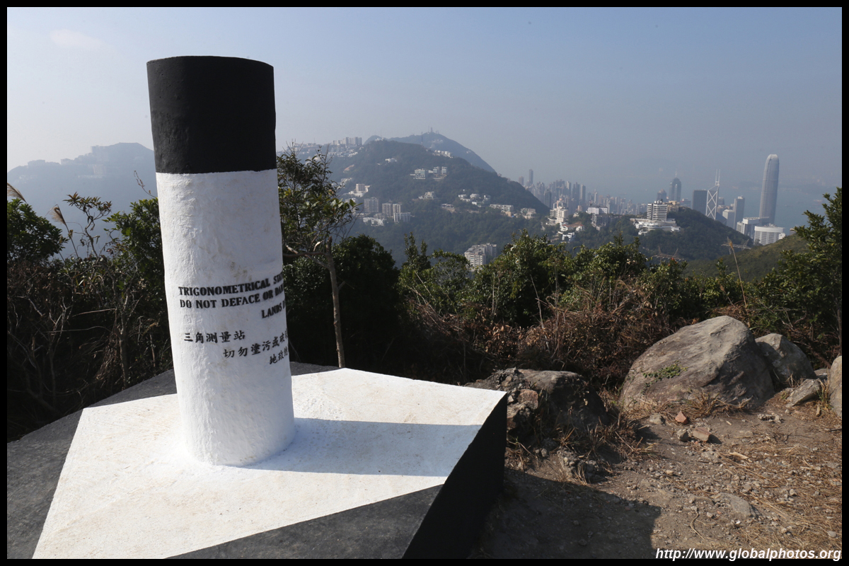
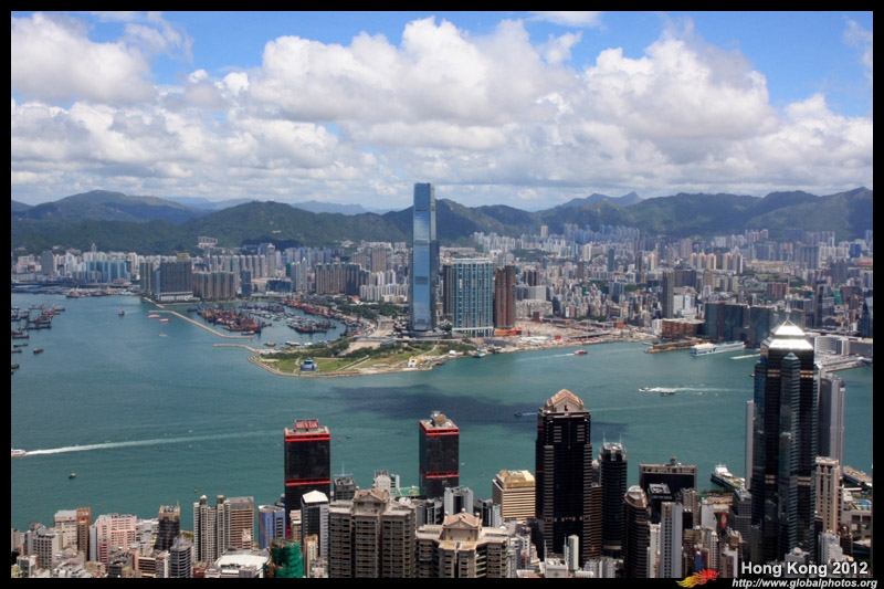
Victoria Peak 2012
|
A must-do for tourists and locals alike, this busy walking path is the perfect place to see the skyline from above. Photographers are readily available at the hotspots staking out the best positions especially around sunset.
|
|
Yuk Kwai Shan
|
Rising 196m above sea level, don't let the height fool you. You need gloves and a good grip on ropes to ascend the steep slopes. Although it is close to Brick Hill, the perspective is a bit different, and you can descend on the other side to reach Ap Lei Pai, a small outlying island.
|